
Secret Tasmania: Clydes Island and Beyond
/
Introduction
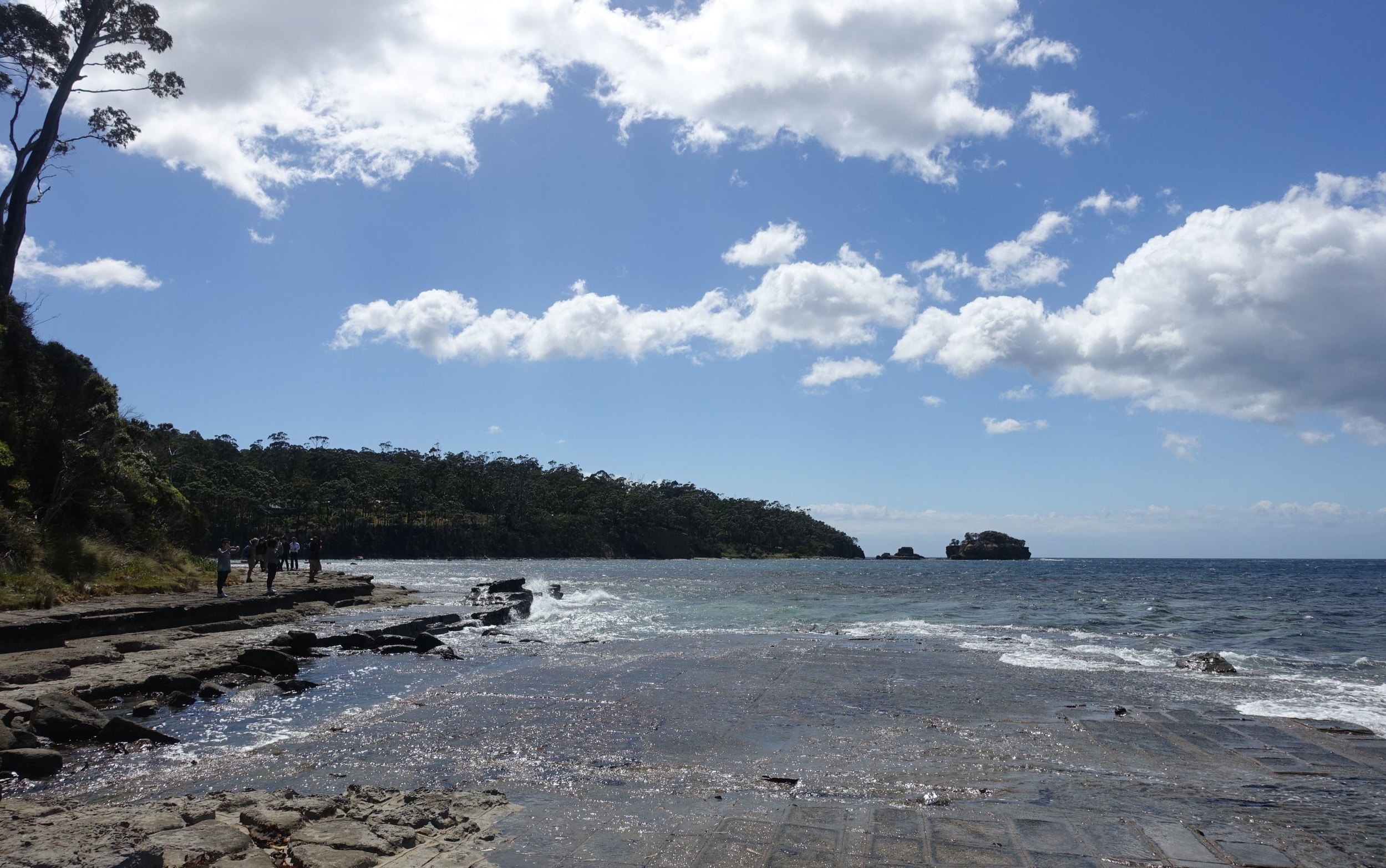
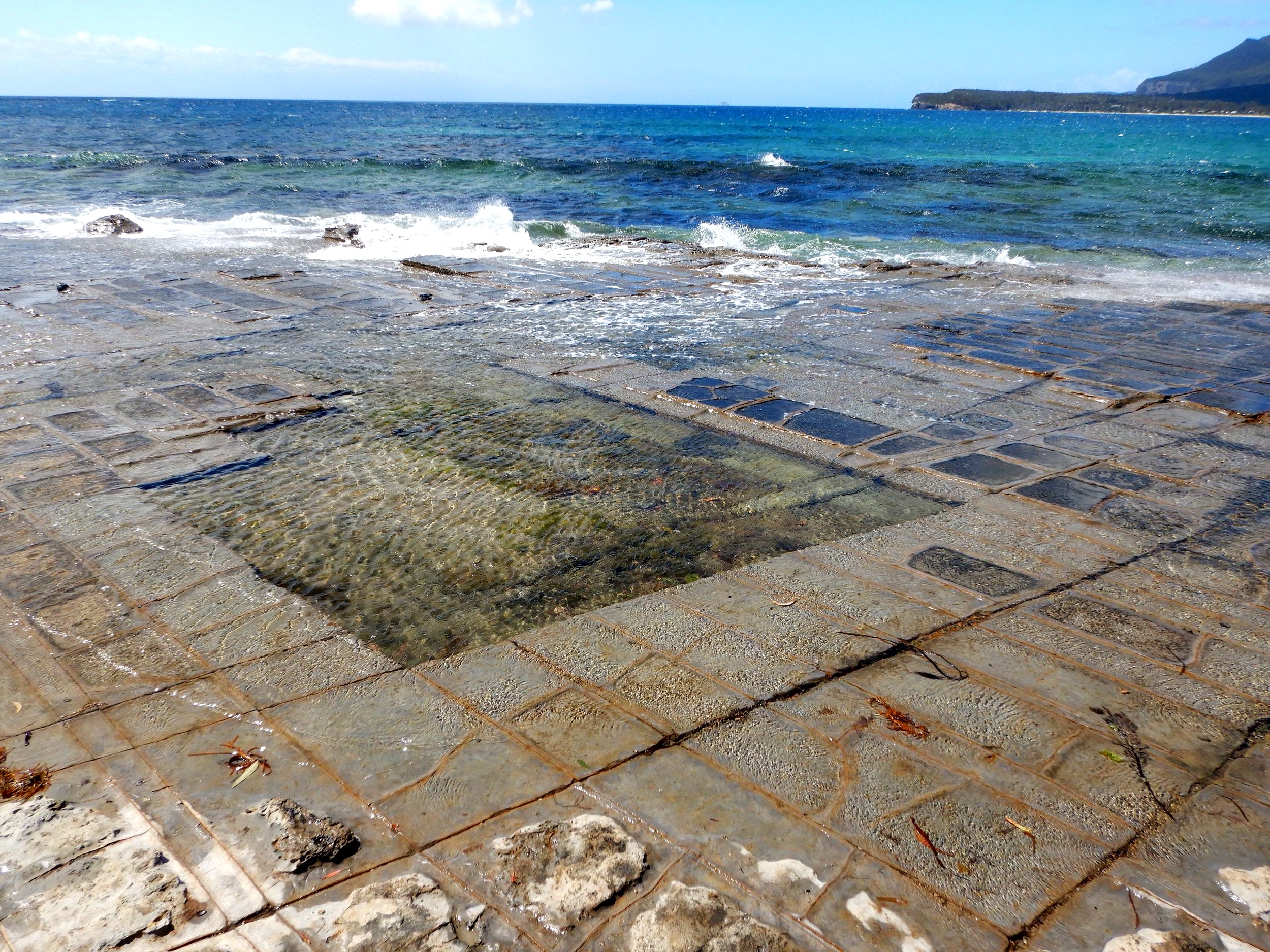
Many visitors to the Tasman Peninsula (an hour out of Hobart) on their way to the Port Arthur Historic Site, make a brief stopover at the Tessellated Pavement State Reserve at Eaglehawk Neck. They come to admire the unusual, geometric patterns in the coastal rock platform.
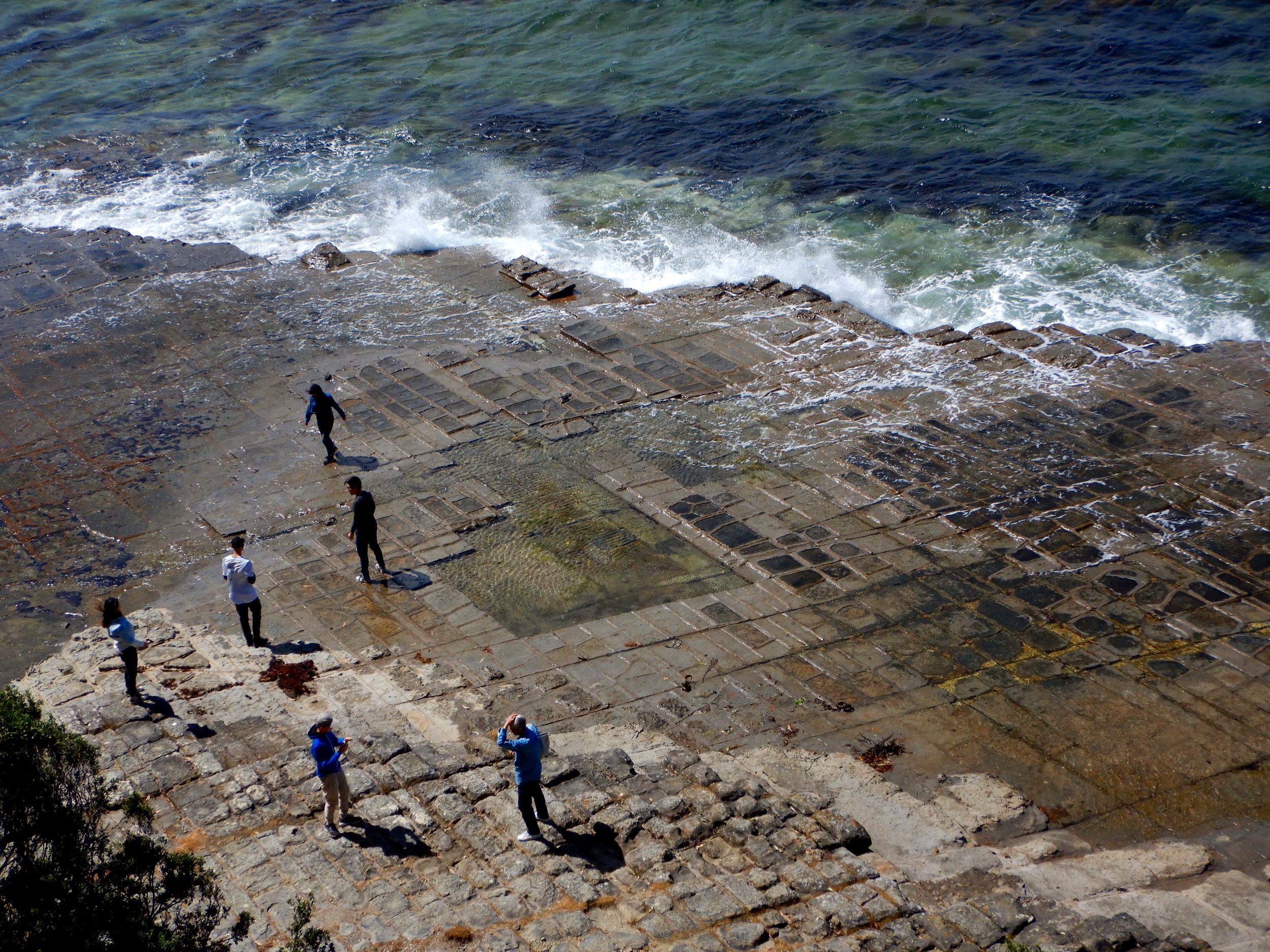
tourists checking out the tessellated pavement
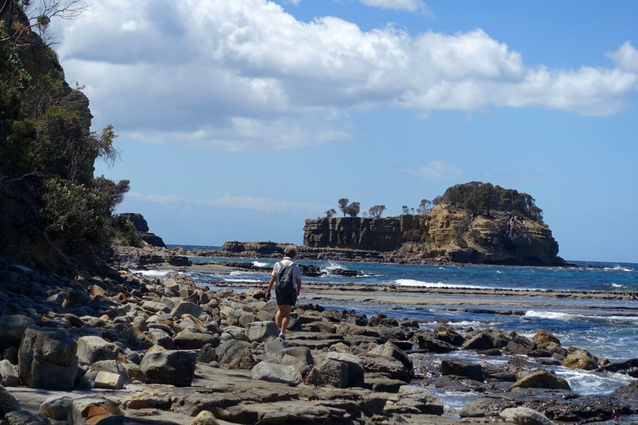
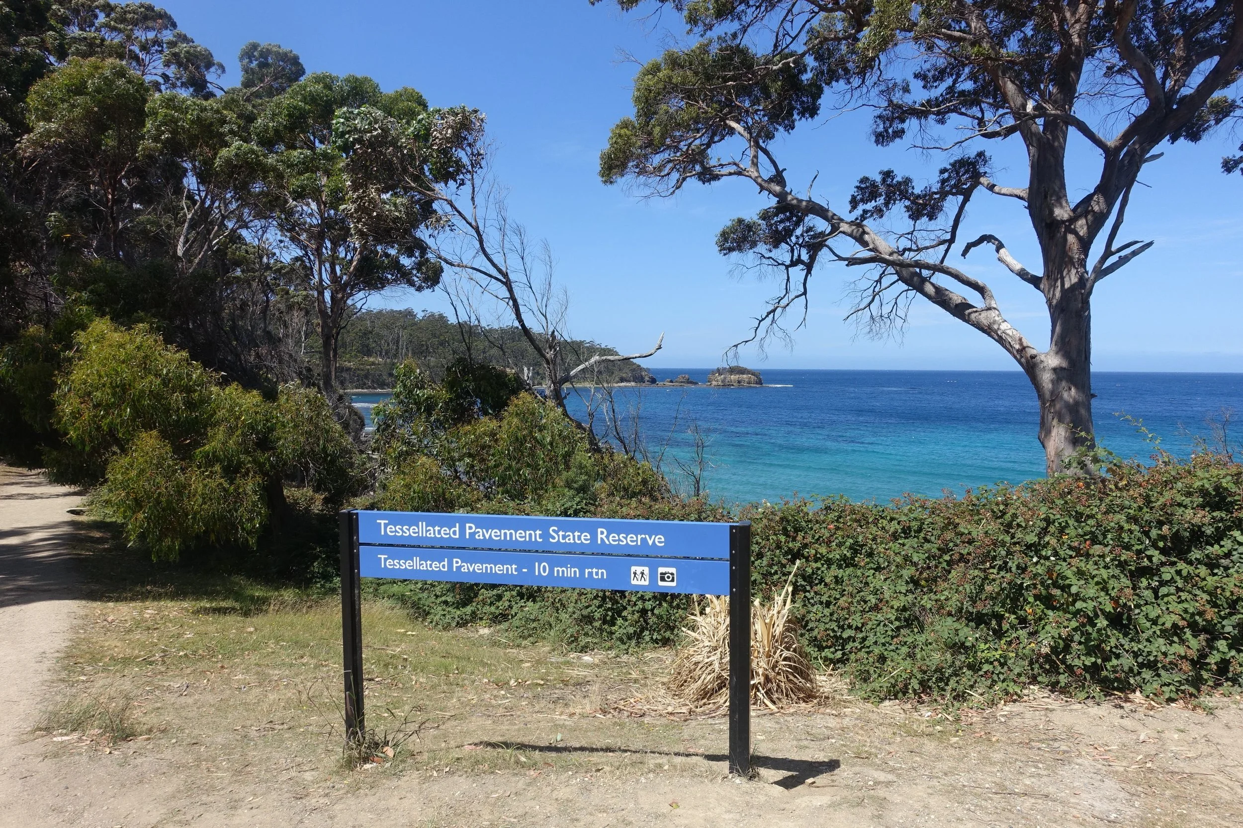
From the Tessellated Pavement the view to the north features a small island adjacent to the shore. This is Clydes Island. Few bother to make the leisurely one kilometre walk along the beach and rocky shoreline to the island.
Clydes island is a short walk north of the tessellated pavement
We decided to have a closer look at Clydes Island for ourselves and then to venture along the cliff-top trail that we’d heard continues beyond.
The Tessellated Pavement
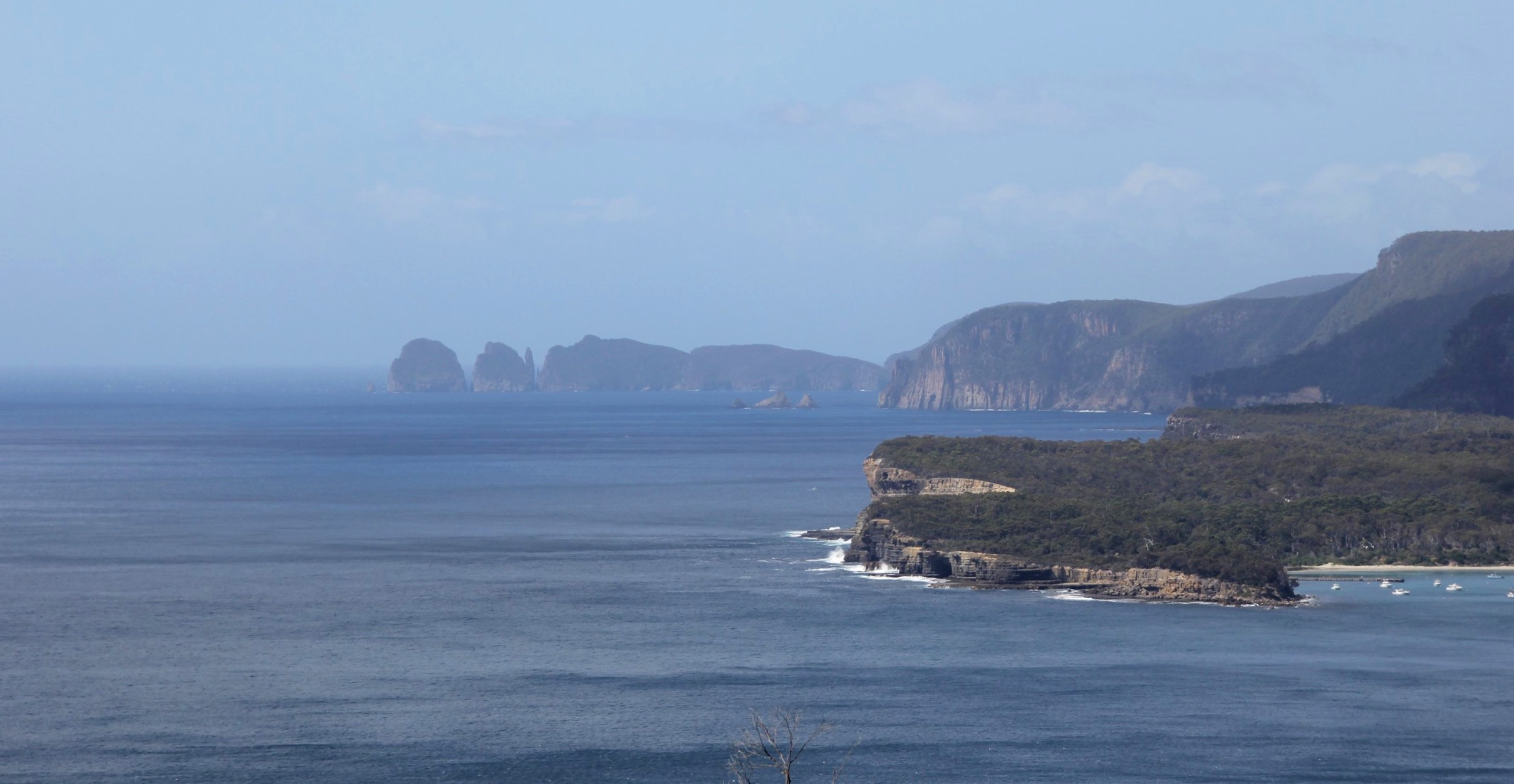
The drive from Hobart to the carpark for the Tessellated Pavement State Reserve takes about an hour. Before descending the steep hill that leads to Eaglehawk Neck, Pirates Bay and the Pavement, we pulled over at the popular viewpoint which provides panoramic views of the Tasman Peninsula coast.
It’s then just a couple of minutes down to the carpark for the Tessellated Pavement. From the carpark a well signposted, easy trail with a few steps leads down to the rock platform.
We wandered around the Pavement for a bit, admiring the strange geology. [Click here if you want to know more about how it was formed]. Meanwhile Clydes Island stood out prominently to the north.
Clydes Island
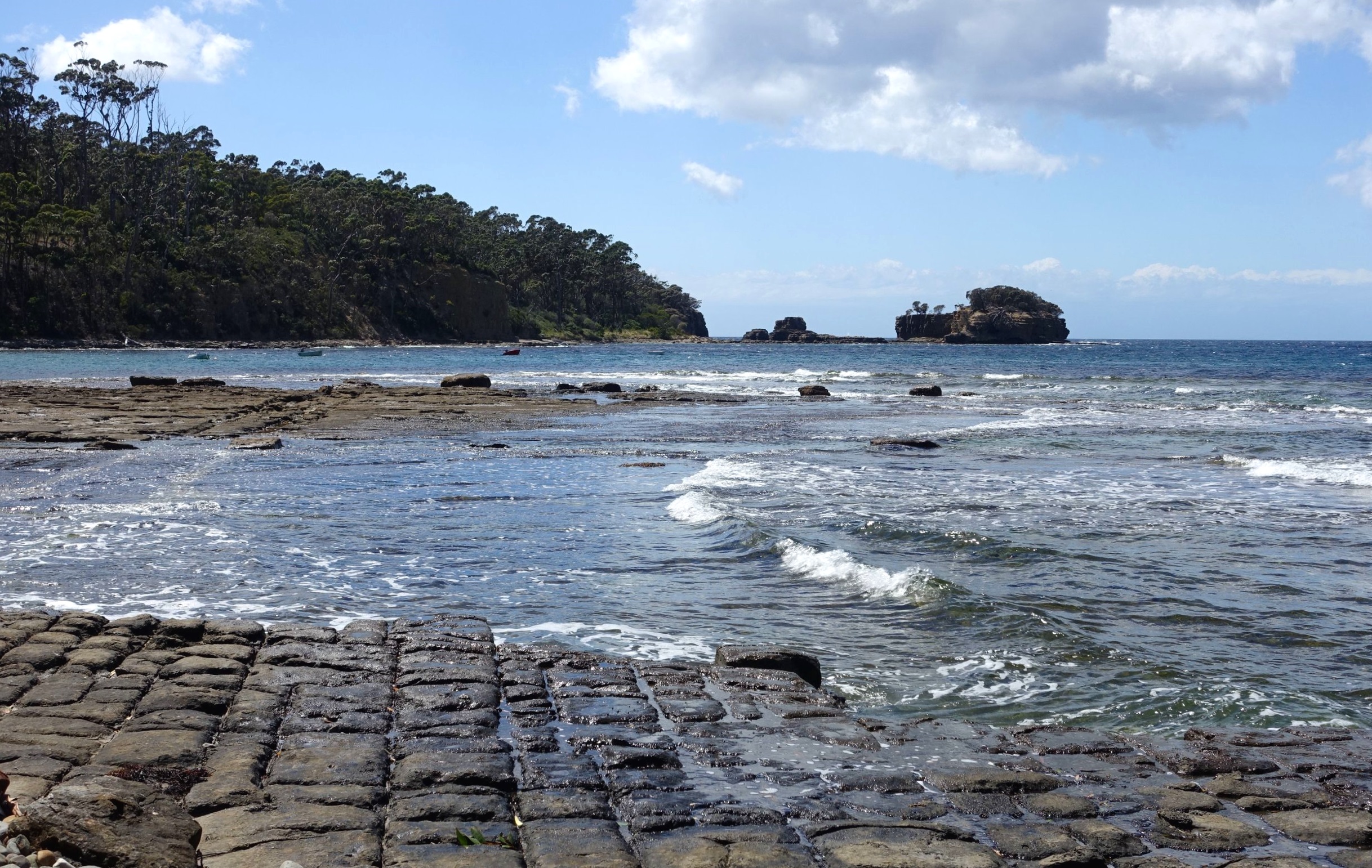
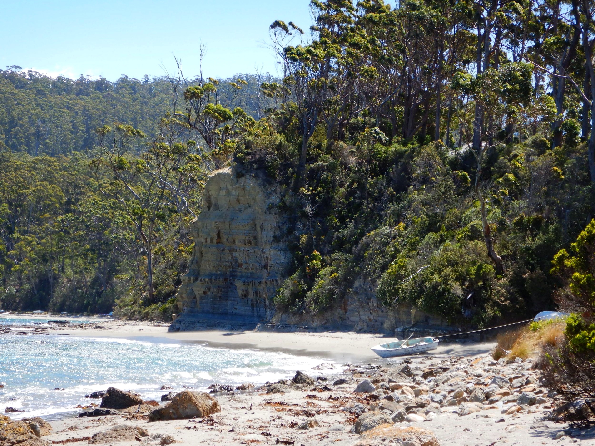
Leaving the Pavement, we headed over some rocks then up the sandy beach towards the island. The route takes in a short rocky section and another stretch of beach, before reaching the rock platform opposite the island.
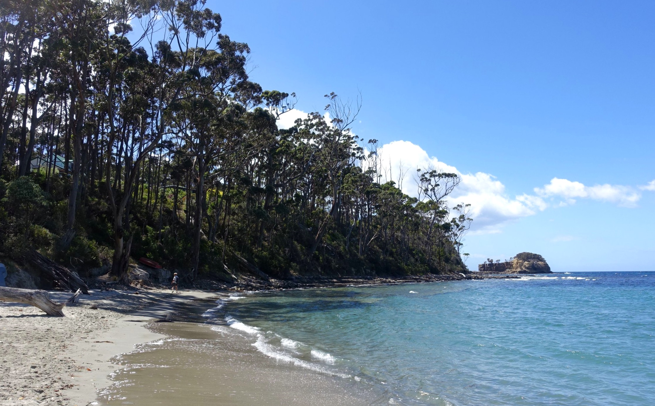
Clydes Island can be visited at low tide with a bit of rock hopping, but on our day the tide was rising, so we decided to just admire it from across the way.
A short distance along the shore, after reaching the section opposite the island, a blue knotted plastic rope indicates the way up to the cliff-top trail along Osprey Head.
The Trail Beyond
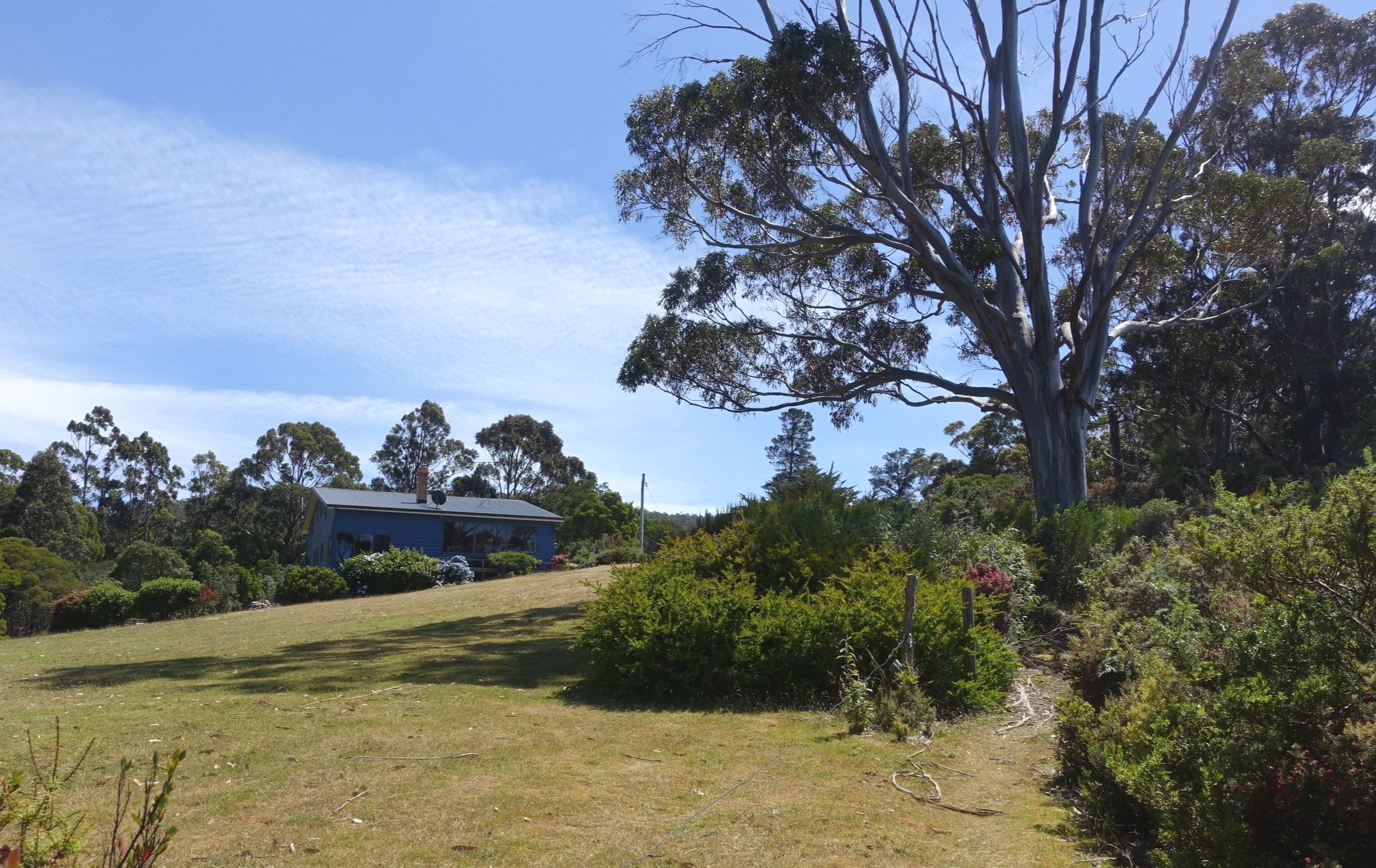
The track, at first, was clear and looked well used. There were a number of properties adjacent to the path.
After a short distance we reached a lookout with an interesting “Pool Area” sign, presumably provided by a local with a sense of humour.
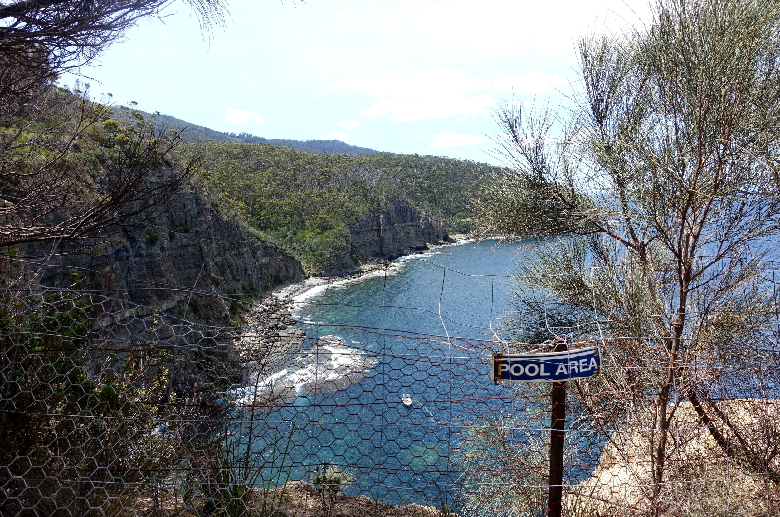
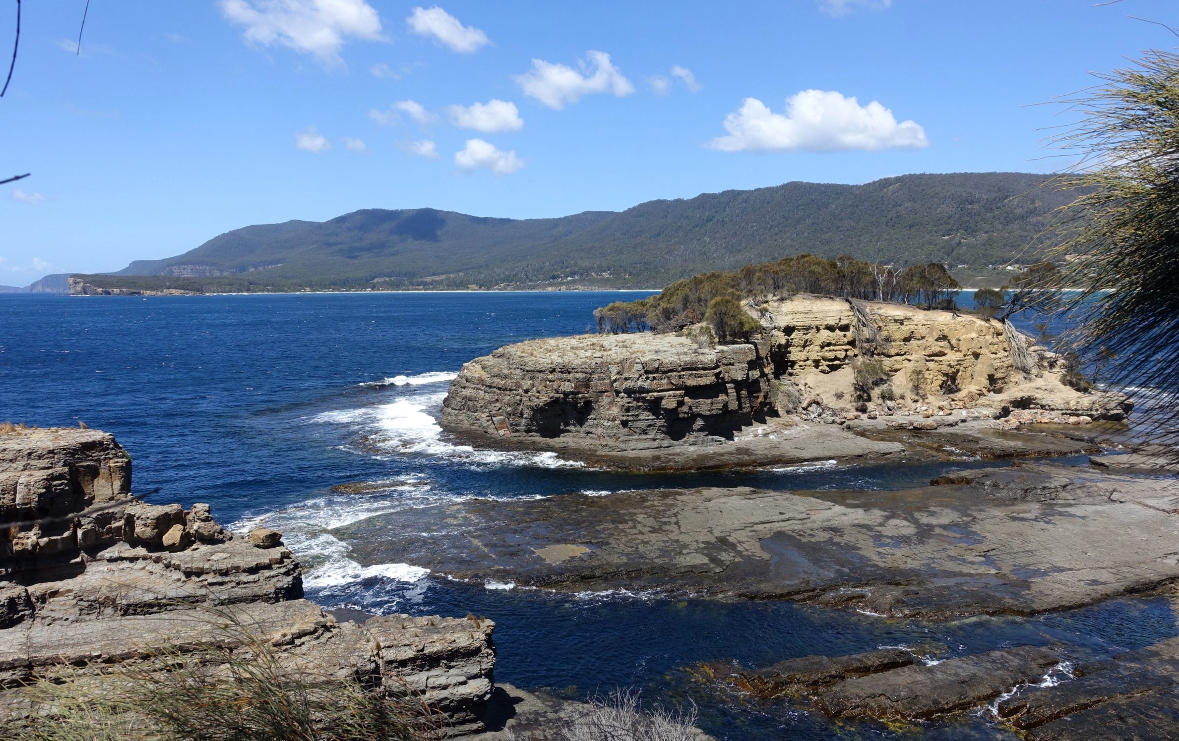
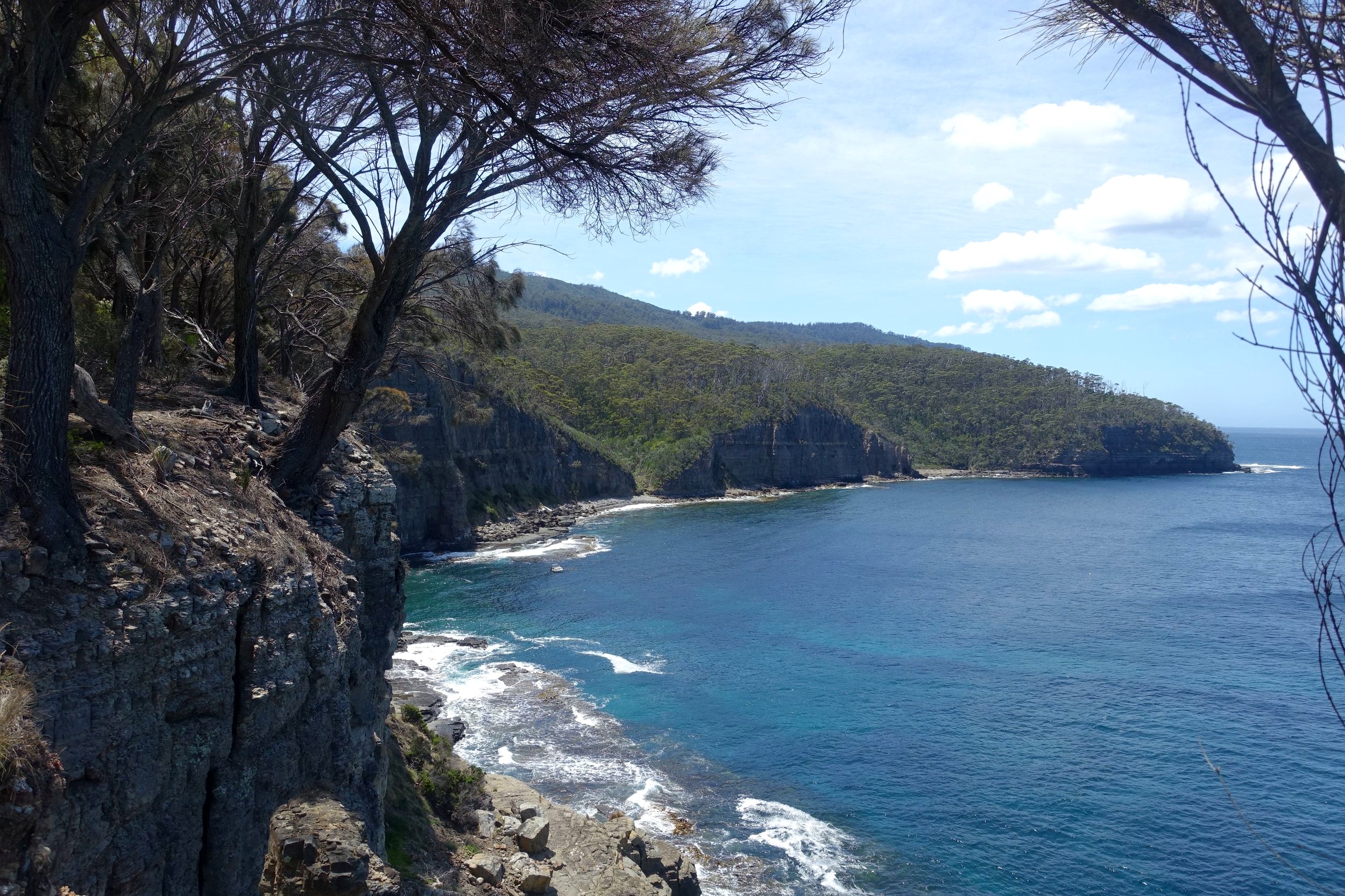
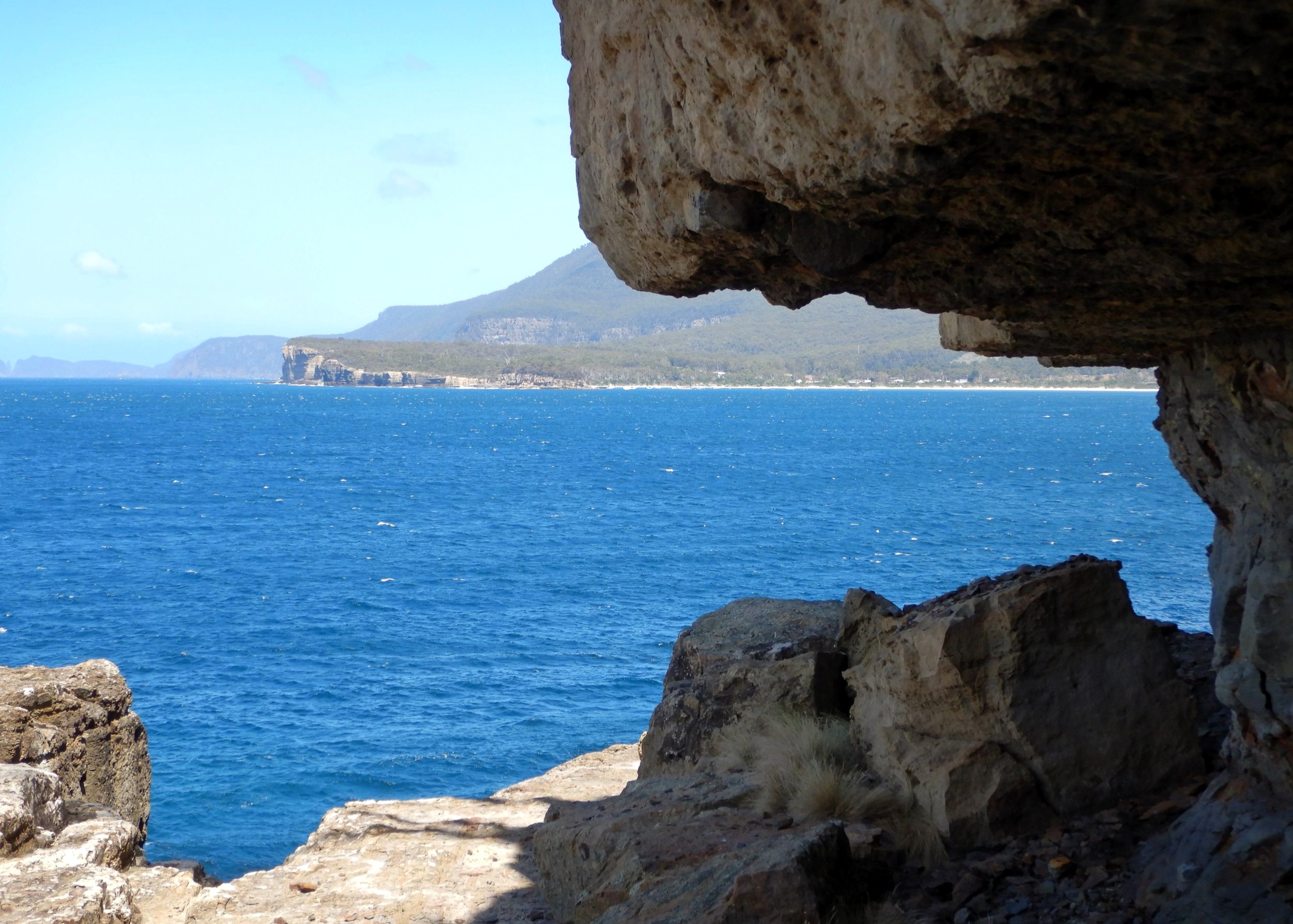
The lookout provided commanding views of the cliffs and rocky inlets to the north.
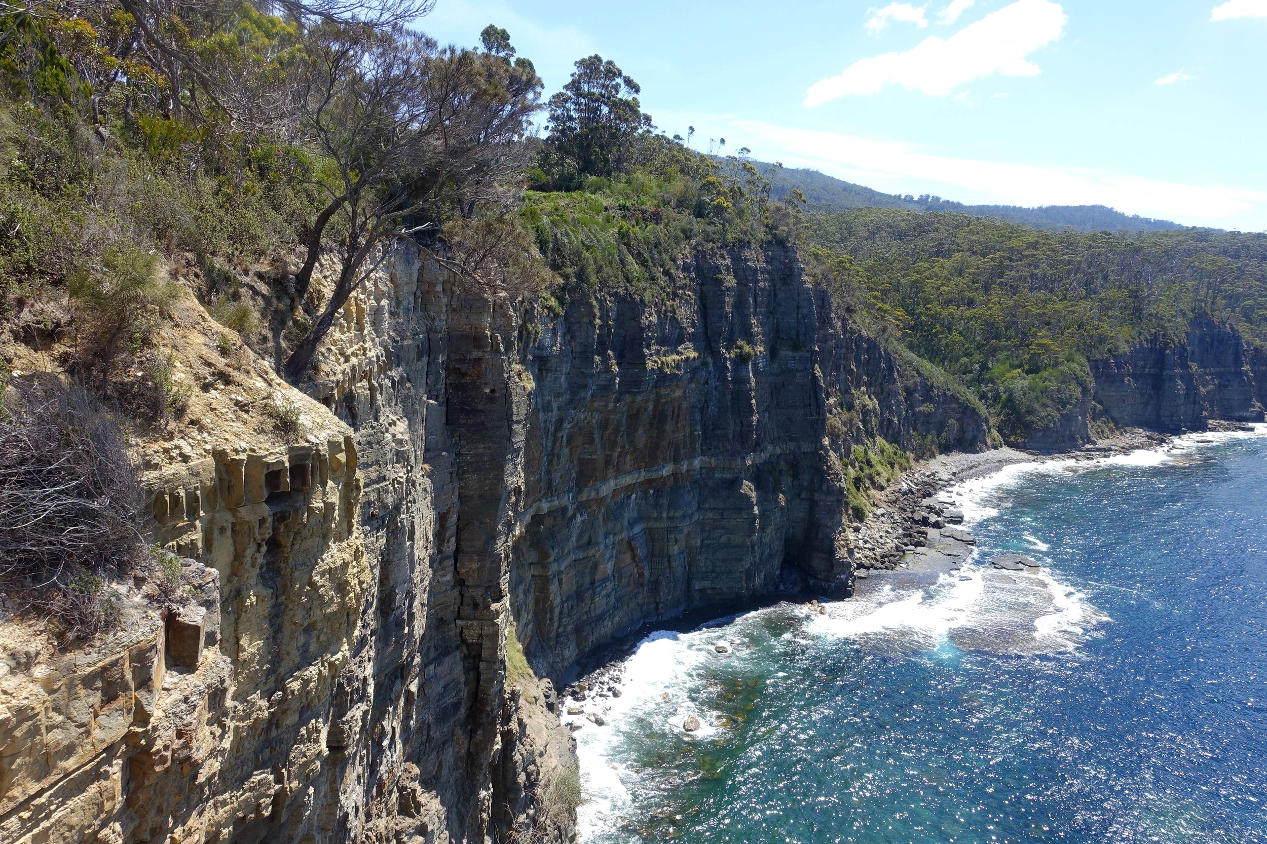
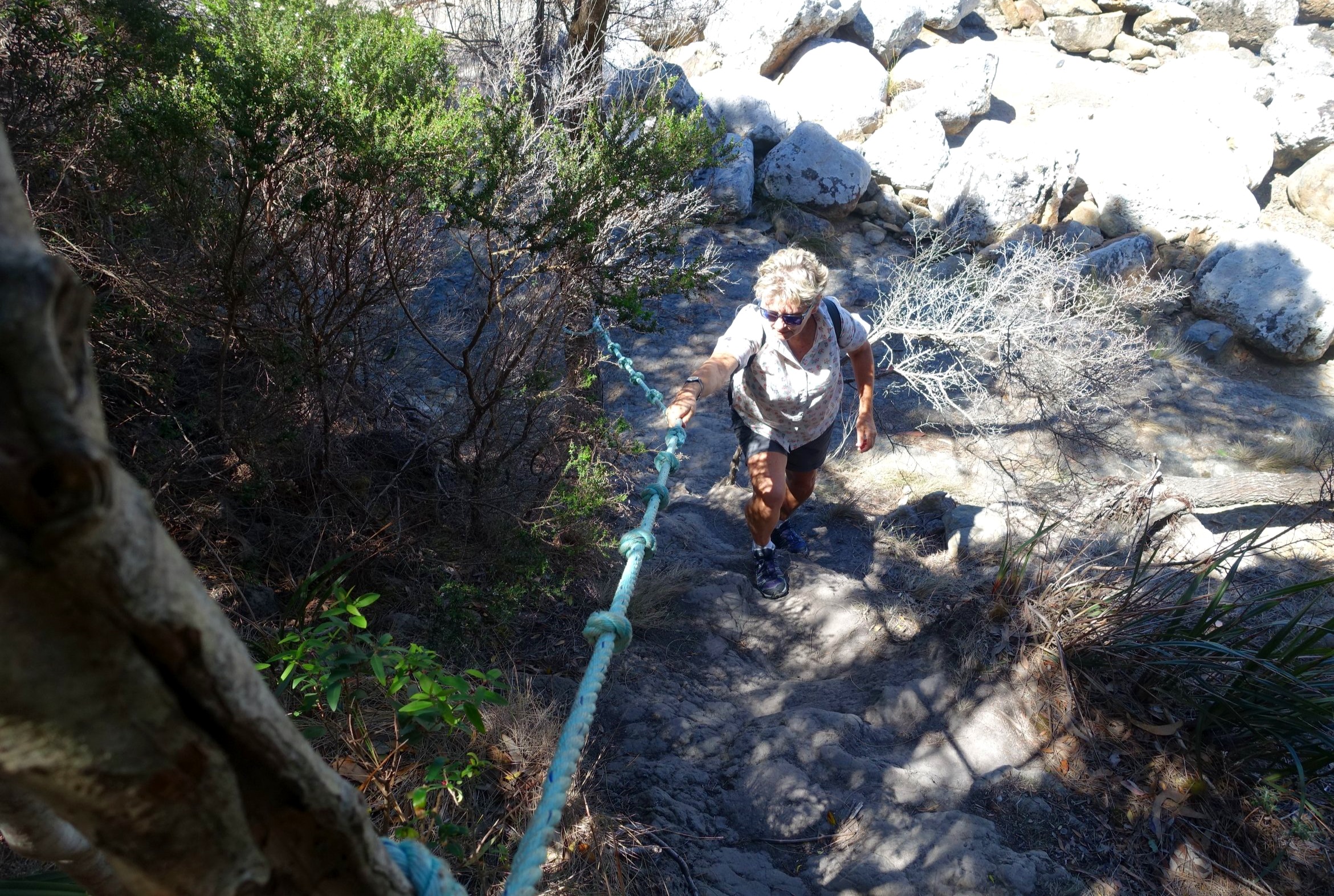
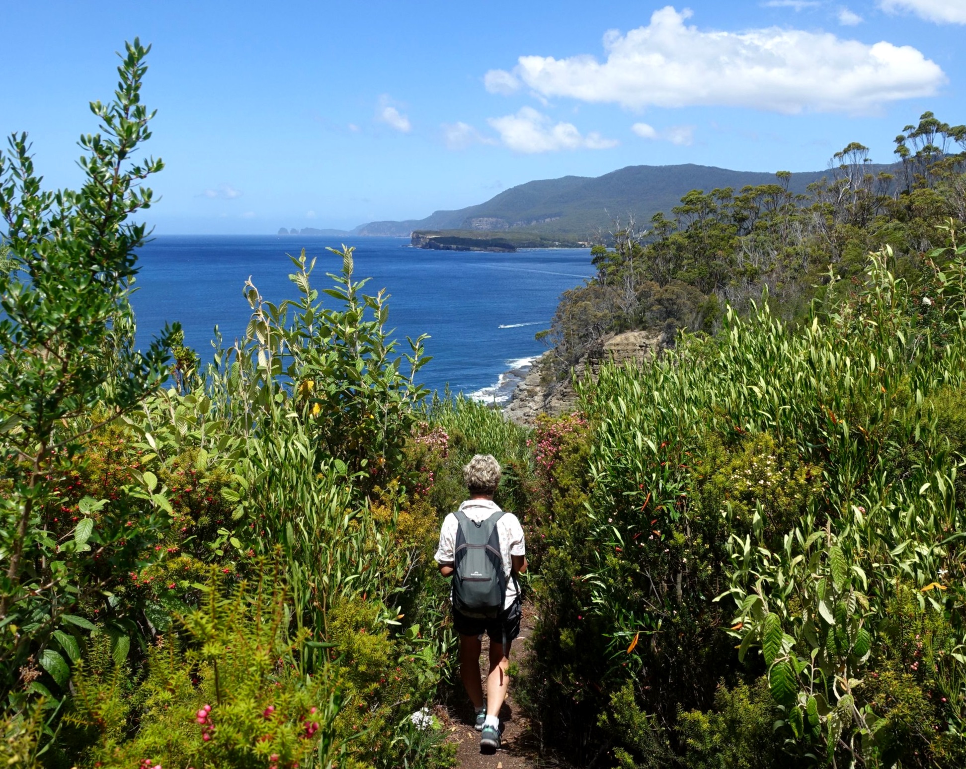
We continued along the trail with human settlement still apparent. Beyond the last house the track became steeper and less well used. We took our time scrambling up and down the dusty, dry trail, finding it difficult to keep a solid footing in parts. It continued with ups and downs until we reached a small thirsty creek.

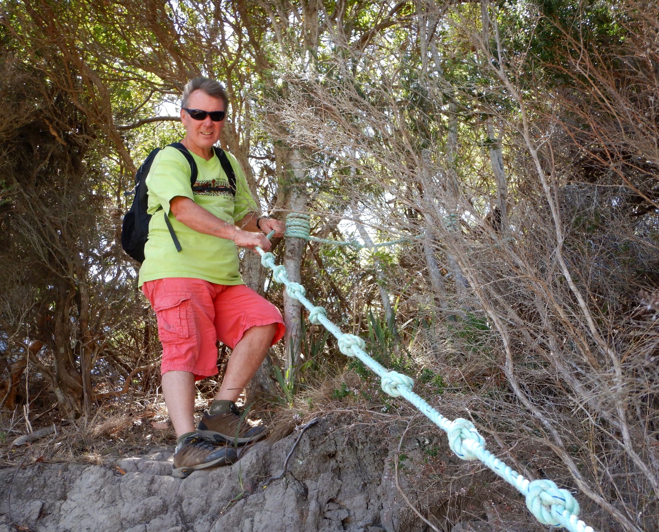
After catching our breath, we resumed our walk, which continued with steepish rises and falls. In some of the more challenging places helpful locals had strung ropes.

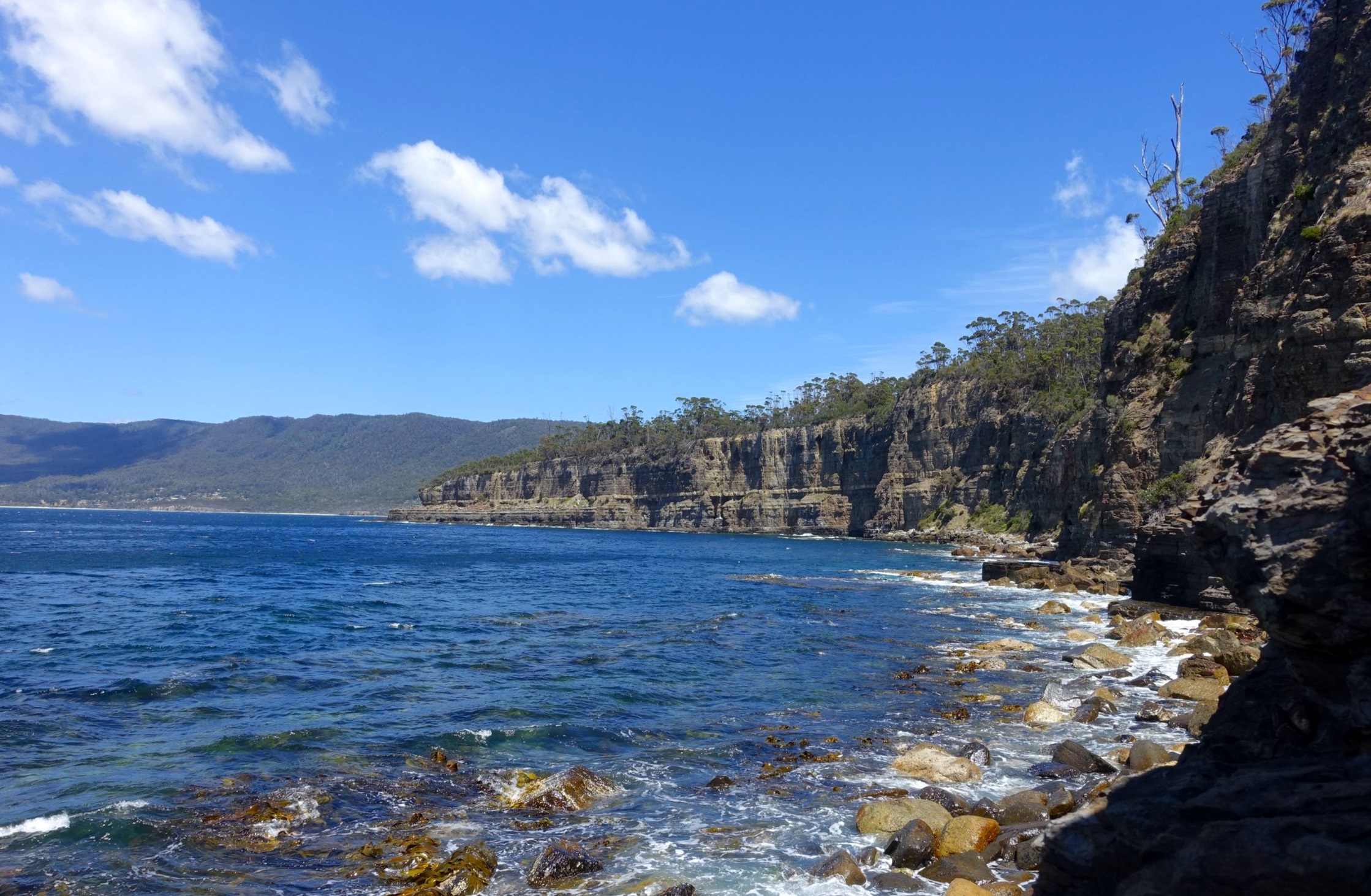
Eventually, after about an hour on from Clydes Island, we emerged onto the rocky shore of a small inlet.

From here we had views to the south of the Tasman Peninsula coastline. It was a warm day, beckoning for a dip after our hot bush scramble, but we couldn’t find a spot that allowed easy access to the water.
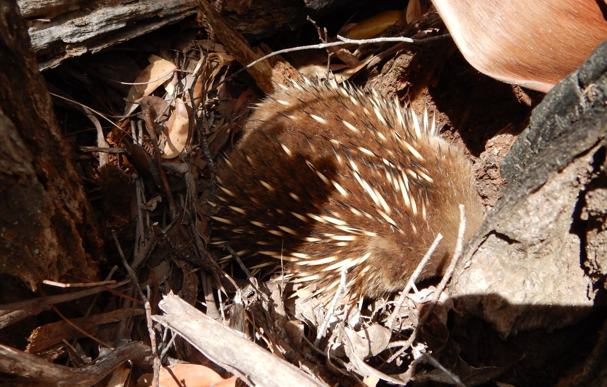
After lunch and taking a few snaps we returned via the same trail. We came across an echidna minding its own business.
Stopping at the “Pool Area” viewing point we were able to work out where we had reached. We could clearly see the inlet we’d gotten to at the northern end of the bay that lies between Osprey Head and the next headland. As the crow flies it was a distance of around one kilometre to the inlet but the track to get there had provided us with plenty of twists and turns.
the little inlet just before the far headland is where we reached
It was a perfect summer day which made the stunning views all the more impressive and enjoyable.
Just before reaching the end of the cliff trail and the blue knotted rope, a small side track lead down to an ancient raised shore platform. It sits around 10 metres above the current shoreline.
It was then back along the beaches and rocks to the car park.
Conclusion
We’re grateful to the great little Tasmanian walks guidebooks produced by Jan Hardy and Bert Elson in the 1990s. It was their “More Family Walks Around Hobart” book that alerted us to the existence of Clydes Island.

Interestingly, Jan and Bert only mention the short initial part of the cliff trail and our 1.25,000 Tasmap for Taranna does not show the cliff track at all, even though it was clearly an old track. So, having stumbled across it, we think it qualifies as “Secret Tasmania”.
The total walk, including viewing the Tessellated Pavement, and lunching at the cove, took us around 3 hours. On a hot day it can easily incorporate a swim at one of the two small beaches on the short walk to Clydes Island or at nearby Pirates Bay Beach.
A good little addition to your next stop at the Tessellated Pavement.
Ken and Cally


