Share

Scan the QR code and open PeakVisor on your phone
Scan the QR code and open PeakVisor on your phone
Dandenong Ranges National Park is a protected park area located in Victoria, Australia. It coverings a large area of forested hills close to the state capital of Melbourne and is considered part of the southernmost reaches of the Great Dividing Range. The park is home to 5 named mountains, the highest and most prominent of which is Mount Dandenong (647 m / 2,122 ft).

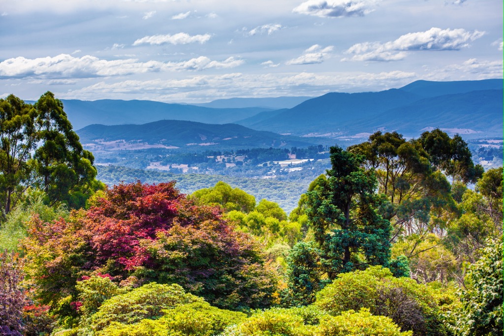
Dandenong Ranges National Park covers an area of around 3,540 hectares (8,700 acres), stretching from Mount Evelyn to Belgrave in the eastern suburbs. It is one of the closest national parks to Melbourne, located just 35 km (21.7 mi) east of the city.
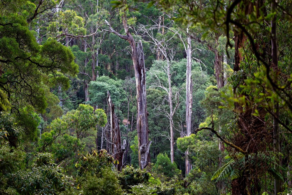
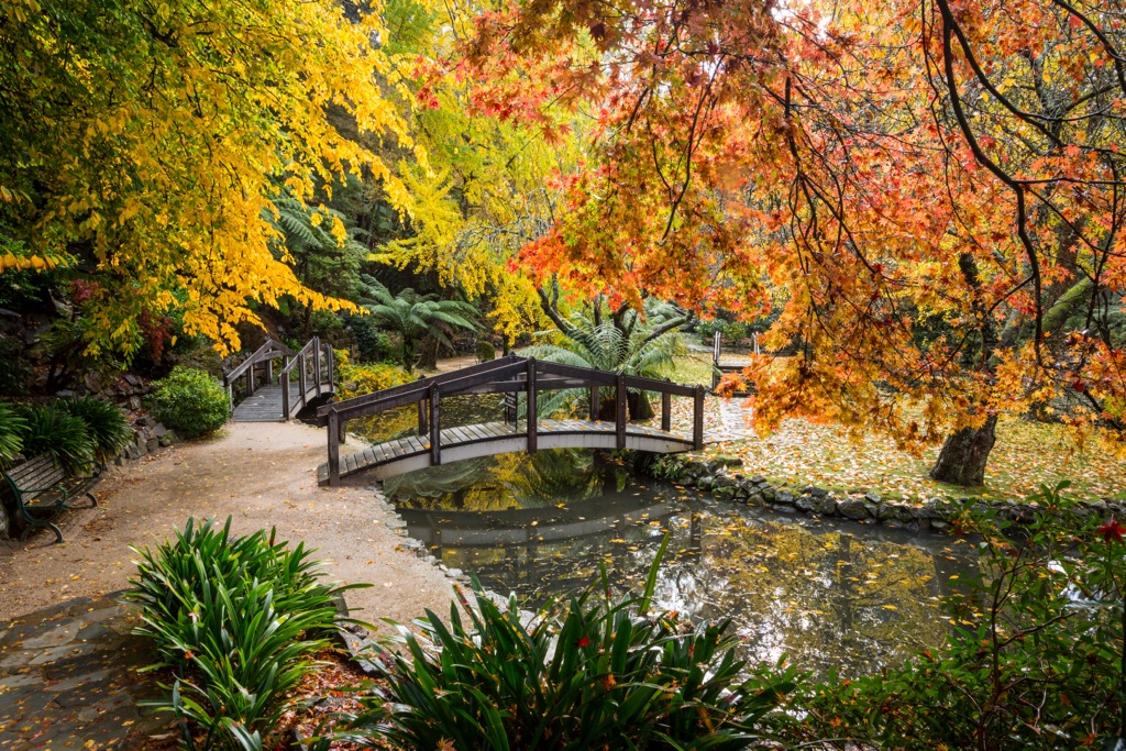
A minor branch of the Great Dividing Range, it consists of hills rising up to Mount Dandenong at 647 meters (2,122 ft). The park area is characterized by dense temperate rainforest, deep gullies, mountain ash trees, flowing waterfalls and river systems making a perfect home for a variety of native animals.
The Dandenong Ranges also provide an important water catchment area for the state. It consists of two of Melbourne’s main water reservoirs, the Cardinia and Silvan Reservoir.

Dandenong Ranges National Park is connected to various other conservation areas in the eastern region of Victoria. To the south of the park, you’ll find Lysterfield Park; to the east is Bunyip State Park, and to the north stretches Yarra Ranges National Park.
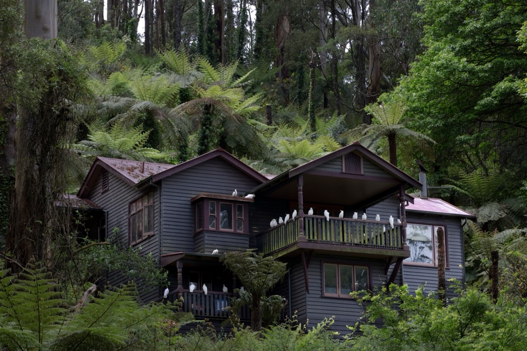
Scattered throughout the Dandenong Ranges are small towns and historic sites, such as an old steam railway. Home to over 100,000 residents, the park is also one of the most popular places to visit from the city.
The Dandenong Ranges National Park is the remains of an extinct volcano that was last active around 375 million years ago. The ranges themselves were formed from volcanic rocks, mainly Devonian dacite and rhyodacite, that erupted when sedimentary rocks collapsed into an underlying magma chamber.

The volcanic landscape has been carved out by a series of deep ridges, gullies, and valleys that have eroded over time. This has created a differing climate zone within the park, with temperate rainforest deep in the sheltered gullies, and drier forest on the exposed ridges. The volcanic soil has also created a place that is lush and well-suited for a variety of flora.
Dandenong Ranges National Park is home to a variety of plants and animals. In the deeper gullies and valleys, lush temperate rainforests thrive, along with towering mountain ash trees and ferns. Higher on the ridges, the flora is drier, consisting of sclerophyll forest of stringybarks and box.

The climate of the Dandenong Ranges is relatively wet and cool, with occasional snowfall a couple of times per year on the higher elevations. This makes the national park a few degrees cooler than the surrounding suburbs of the city.
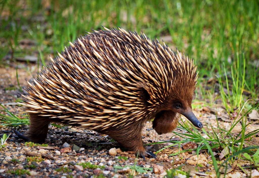
Dandenong Ranges National Park is also home to a variety of native animals. Common mammals include echidnas, wombats, sugar gliders, swamp wallabies, and kangaroos.

It’s also a popular bird watching area, with lyrebirds, kookaburras, crimson rosellas, and cockatoos commonly spotted. The Powerful Owl is also found in the park, this incredible nocturnal predator is the largest owl in Australia and found mostly in old growth forest.
The park’s lush temperate rainforests and towering mountain ash trees provide a perfect habitat for these animals to thrive in their natural environment.

Dandenong Ranges National Park sits on the Wurundjeri People’s custodial land. The name Dandenong is derived from the Woiwurrung language of the Wurundjeri People. However, the exact origin of the name is unknown, except it is believed to have referred to a watercourse in the area rather than a mountain.
Mount Dandenong (647 m / 2,122 ft) was originally known as Corhanwarrabul by the Wurundjeri People, who hunted in the higher ranges during the warmer months.
The first European to explore the Dandenong Ranges extensively was botanist Daniel Bunce, who made records of flora and fauna in the hills during the early 1840s. Within the next decade, settlers moved into the foothills of the ranges for timber felling and gold prospecting.

Despite large tracts of clearing, it was recognized early on that the ranges were an important habitat to protect for future conservation. In 1867, forest reserves were established including Ferntree Gully National Park, Olinda State Forest and Sherbrooke Forest. These laid foundations for the eventual creation of the broader Dandenong Ranges National Park in 1987.
Tourism arrived early in the Dandenong Ranges due to its visibility from the city. A railway line was built all the way to Upper Ferntree Gully in 1889 from Melbourne to allow greater ease of transport for people. A narrow-gauge railway was then extended to Gembrook in 1900. Since its closure in 1953, the trainline has been restored and currently runs as a tourist line known as Puffing Billy.
During the 1920s and 1930s, wealthy families from Melbourne frequented the Dandenong Ranges for weekend retreats. Many built elaborate country homes and guesthouses for other visitors, some of which remain today. As the eastern suburbs of the city extended outwards, more permanent residences were established and today, there are many small towns within the park area.

Dandenong Ranges National Park is home to some of the best walks near Melbourne. Most of the trails incorporate waterfalls or historic sites, making it a great opportunity to explore the rainforest on foot.
Here are some of the best hikes to do in Dandenong Ranges National Park on your next visit:
One of the most serene walks to do in Dandenong Ranges is to Sherbrooke Falls. A 2.4km (1.5 mi) return trail from Sherbrooke Picnic Ground winds its way through the dense rainforest, with towering trees up to 200 years old. While the cascading falls are not huge, it’s a beautiful sight hidden amongst the greenery of the forest at the end of the trail.

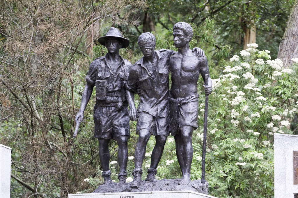
One of the most popular walking tracks in the eastern suburbs of Melbourne and a must-do in the Dandenong Ranges. It was created in the early 1900s and consists of the 1000 Steps Walk, which was originally constructed by trunks of tree ferns. The army veterans of the Kokoda campaign adopted this park as their memorial site in 1998, because of its similarity to the terrain they endured in Papua New Guinea.
Beginning from Ferntree Gully Picnic Ground this moderate-hard walk can be completed in a loop by climbing the steep hillside via the 1000 steps to a clearing where you can enjoy fantastic views over Melbourne. To return, you can opt for the Lyrebird Track back to the carpark, taking you down through the rainforest on a more gradual decline.

Burke’s Lookout is often regarded as one of the best lookouts in Dandenong Ranges National Park. There are several ways to reach it. The shortest option is driving most of the way and parking on Osprey Road. From there, you can follow Kyeema Track for less than a kilometer (0.6 mi) to the lookout.
However, the most popular way to reach Burke’s Lookout is via Glasgow Firetrail. Beginning from Glasgow Road in Kilsyth on the west side of the ranges, the steep trail climbs around 300 meters (985 ft) in just 1.2 km (0.7 mi) to the lookout. It’s commonly used as a training hike for people getting ready for longer treks or by fitness groups running training programs.
One of the few dog-friendly hikes in Dandenong Ranges National Park. It’s a 7km (4.3 mi) return walk near Olinda that’s perfect for all fitness levels and ages. The path is wide and spacious with dense foliage on either side broken up by occasional views across to Silvan. Starting from Falls Road, it skirts around the National Rhododendron Garden and is a relatively easy stroll.

Take a family-friendly hike in the Dandenong Ranges National Park, starting from the Ferntree Gully Picnic Area. This 3km (1.9 mi) loop is an easy walk through the forest that’s perfect for kids. You’ll have plenty of opportunities to watch birds, including cockatoos, rosellas and kookaburras that are commonly found in the area.
Dandenong Ranges National Park is home to various small villages and towns east of Melbourne. As camping is not allowed within the park boundary, staying in one of the towns is the best way to be close to the national park.
Here are the closest towns to Dandenong Ranges National Park:

Dandenong Ranges National Park is located just a short drive east of Melbourne in Victoria, Australia. It’s a popular destination for tourists and locals alike, with harming mountain villages and forest retreats scattered throughout the ranges.
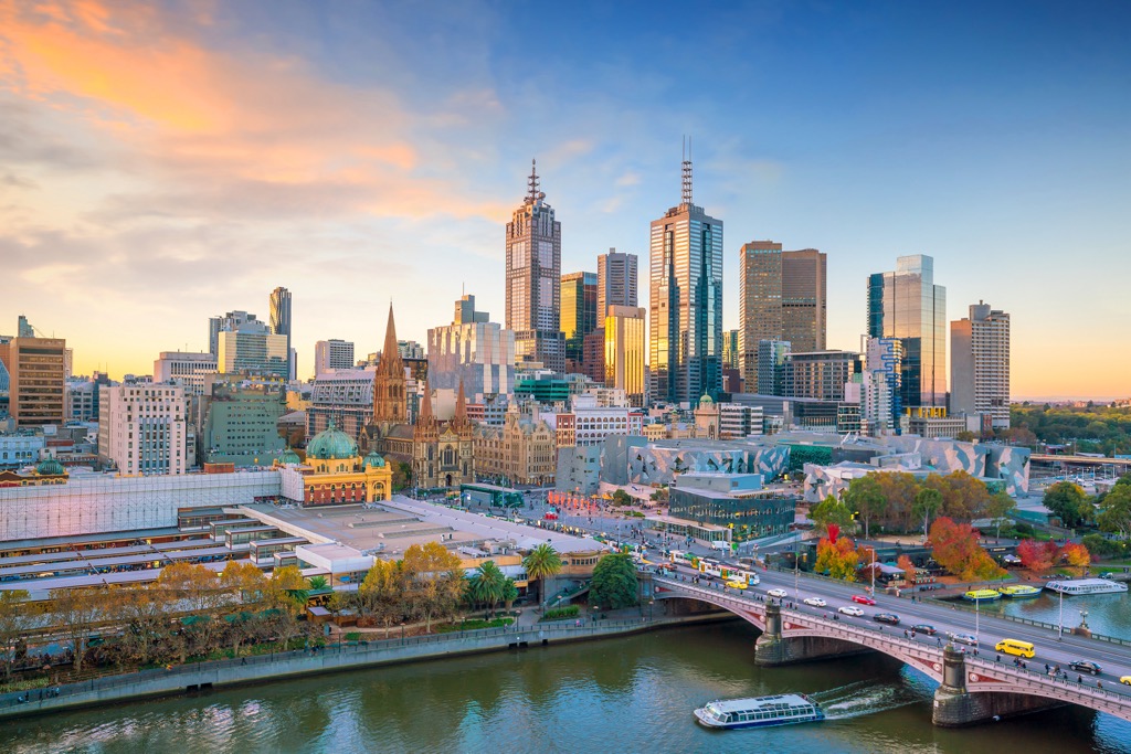
The closest capital city to Dandenong Ranges National Park is Melbourne, which is located 35 km (21.7 mi) west of the park. You can easily reach the park by driving via the M1 from Melbourne, although some of the roads leading up to the park can be narrow and winding.
Melbourne is known for its lively nightlife, coffee culture, shopping scene, and variety of architecture. It’s also a central transport hub, with a domestic and international airport and train and bus stations. There are plenty of things to do in Melbourne, with iconic attractions including the Melbourne Arts Precinct, Federation Square, Bourke Street Mall, and Southbank area.

Explore Dandenong Ranges National Park with the PeakVisor 3D Map and identify its summits.