REGION 5. The Riverina
This area consists mostly of low lying alluvial plains close to the Murray river which forms the border between Victoria and NSW. Extending from roughly Swan Hill in the north-west, south to Boort and then east to Elmore, Shepparton and Albury. It is a land of drought and flooding rains. Irrigation schemes have channelled water right across the plains, and some areas have saline soils. With its diversity of habitats including woodlands, grasslands and wetlands this rich region holds a lot of bird species in a relatively small area.
Geology:

Formed over the last few hundred thousand years, high rainfall, flooding and subsequent deposition have formed red, brown and grey clay soils of varying salinity with deposits varying from 90 to 300 metres thick ! Current drainage of the region consists of many smaller creeks and rivers most of which drain into the Murray river. Over time drainage lines have changed, and there are many prior stream sites, with heavy clay soils and Black Box trees (Eucalyptus largiflorens) which rarely flood now. There are also many shallow dry lake beds, some of which may fill in exceptional circumstances. Permanent natural wetlands are rare, but there are now a number of irrigation storages. and in times of high rainfall many temporary wetlands fill as rivers flowing north flood out across the plains, especially along the Loddon and Avoca rivers near Kerang and the King and Ovens rivers near Wangaratta and Yarrawonga.
Climate:
The climate is quite similar to that of the southern parts of the mallee country just to the west. Hot days in summer. Frosts in winter and rainfall around 350 mms annually. As with much of central and western Victoria hot northerly winds can turn to cooler south westerlies as cold fronts arrive, dropping temperatures by 10 to 20 degrees in just a few hours.
Vegetation types :
Although a largely flat landscape, there are subtle rises and dips and a variety of soils with a subsequent diversity of vegetation communities. Where flooding is regular River Red Gum (Eucalyptus camaldulensis) woodlands dominate, including some of the largest Red Gum wetlands in the country at Barmah and Gunbower. A ground cover of grasses, rushes and sedges is common in these woodlands. Water extraction has reduced the frequency and extent of flooding with a resulting change in plant communities slowly occuring.
Black Box (Eucalyptus largiflorens) woodlands are common in the western and north-western parts of the riverina region growing on heavy clay soils where flooding is less common. A large spreading and very drought hardy tree which can also tolerate some salinity, Black Box is commonly associated with the wiry shrub called Tangled Lignum. Also drought and flood tolerant lignum provides a great home for smaller birds such as Fairy-wrens and when flooded provides nesting sites for many waterbirds.

Black Box and Lignum
Areas of the plains with lighter soils and a little relief had extensive Grey Box woodlands but these are now much reduced. Localised sandier soils often had White Cypress Pine (Callitris glaucophylla), with the largest remaining stand located on the Terricks ridge.
Shallow ephemeral wetlands across the plains have undergone major change, with grazing, and drainage schemes altering many. Lignum, Cane grass, and many aquatic plants such as Nardoo provided rich feeding grounds, and the endangered Brolga, Australasian Bittern and Australian Painted Snipe all still take advantage of remaining swamps when flooded.
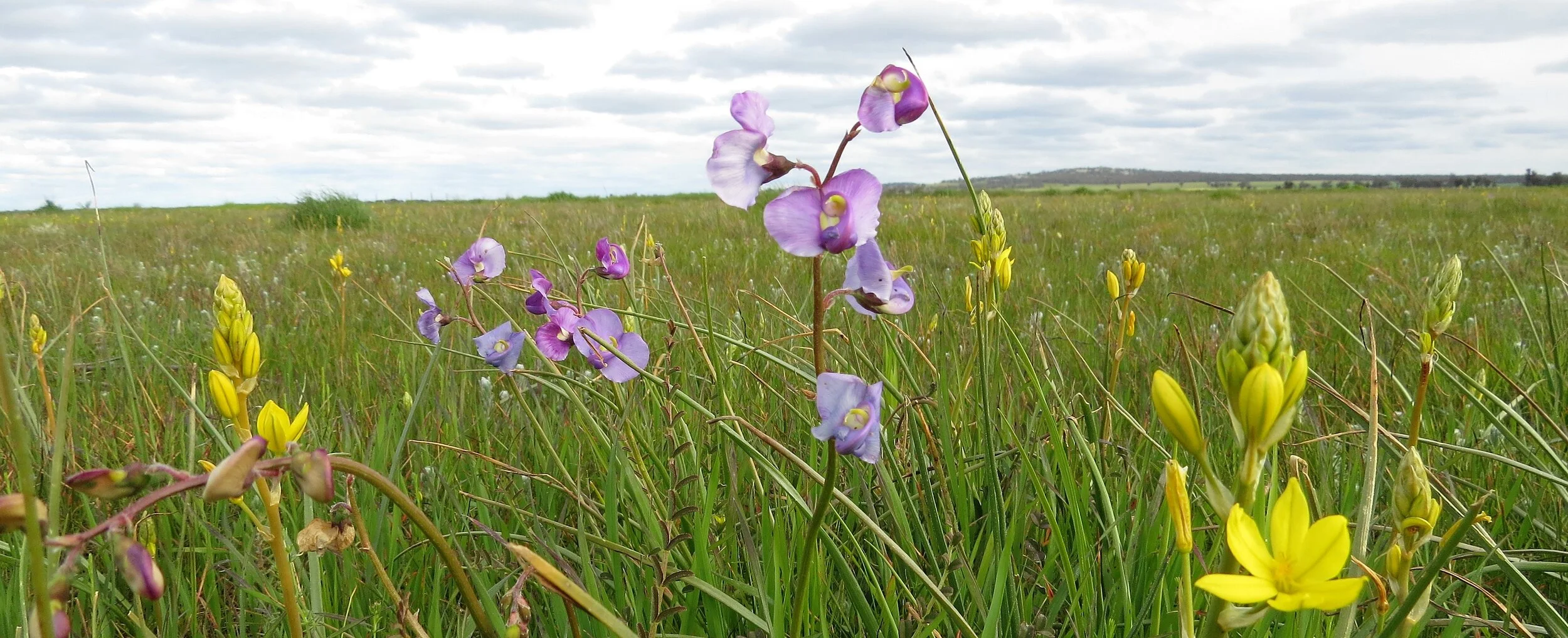
Finally large expanses of flat plains country was a mix of treeless native grassland, and saltbush shrubland, with the beautiful Acacia pendula (Boree or Weeping Myall) occurring as an open woodland. Vast numbers of sheep, and ploughing to grow grain crops has wiped out most of these communities, but some still remains supporting rare plants and the critically endangered Plains-wanderer is a keystone species. These grasslands can undergo dramatic fluctuations in biomass between drought times and floods.
Site Descriptions :
Terrick Terrick National Park

The recently expanded Terrick Terrick NP preserves three quite different habitats which are all now linked together. The original park occurs on a granite ridge and is one of the largest remaining cypress pine/eucalypt woodlands in Victoria, native grasslands are preserved to the north-east, and the Bendigo creek frontage forms the third section. The pine woodlands are the best known and birdiest parts of the park
Getting there:
Situated some 80 kms directly north of Bendigo, take the Bendigo Pyramid road to Mitiamo and continue north from there on gravel roads. The tracks within the park are good for 2WD, even after rain with care
Key sites:
A good place to start is the picnic ground at the base of Mt Terrick Terrick. Many of the park’s birds may be seen in this area including Australian Ringneck and Gilberts Whistler.
Allen track which gets you there takes you through typical pine woodland with Red-capped Robin and Chestnut-rumped Thornbill.
Reigels rock in the north-east of the forest is also interesting, and can attract Painted and Black Honeyeaters in spring and summer depending on the year.
Rodgers track runs through the western part of the forest, and makes for a nice drive with plenty of possibilities.
Foot access to the grasslands is easiest from the Mitiamo Kow Swamp road near the Old Davies Homestead. Walk past the Davies homestead and out into Possum paddock, and down through Creek paddock until eventually you reach the Bendigo creek. Both Fabians and Yarran paddocks to the west of the road have never been ploughed and are worth a walk also. Best time for the grasslands is early spring for wildflowers and spring/summer for birds

East of the Bendigo creek is a vast treeless plain ( the Patho plains) where a lot of land has recently been acquired to add to the TTNP. Foot access is allowed in these areas where in the right season a wide range of grassland species may be seen. In times of above average rainfall or flash flooding ephemeral swamps spring up in the lower lying spots attracting all sorts of waterbirds. These can include rare species such as Brolga, Australian Painted Snipe, Australasian Bittern and Plumed Whistling Duck.
Key Species:
In the forest: Australian Ringneck, Gilberts Whistler, Painted Button-quail, Crested Shrike-tit, Red-capped Robin, Hooded Robin, Western Gerygone (spring and summer), Southern Whiteface, Chestnut-rumped Thornbill
In the grasslands:Spotted Harrier, Black Falcon, Brolga, Banded Lapwing, Australian Pratincole (on barest paddocks usually during droughts), Plains Wanderer, Stubble Quail, Little Button-quail, Red-chested Button-quail (after summer rains), Brown Songlark, Horsfield’s Bushlark, Zebra Finch, White-winged Fairy-wren
and along the creek: Black Falcon, Spotted Harrier, Black-tailed Nativehen, Grey-crowned Babbler, Crested Shrike-tit, Southern Whiteface
Murray River Red Gum forests (Gunbower island and Barmah Forest)

The extensive River Red gum forests of Gunbower and Barmah have both been recently declared National Parks. Naturally they would have flooded on a regular basis. This has been much reduced in recent times through water diversions for agriculture, but environmental allocations now see more regular inflows to these forests again. Both have an extensive network of bush tracks to explore, however after rain or flooding access is drastically reduced. Park webpages give up to date track information. Camping is still allowed along some sections of the river.
Getting there:
The Gunbower island, west of Echuca, runs from Torrumbarry in the south to Koondrook in the north, with many access points in between. Some more reliable well maintained access points include Spences bridge road, NW of Cohuna, the signposted Forest Drive from Cohuna, Brereton road near Gunbower and Lock road out to Torrumbarry weir. One of the nicest stretches is out of Leitchville, access the forest on O’Reilly road, across Holmes bridge and take Broken Axle track towards the river and River track along the river.
The Barmah forest, east of Echuca, runs from Barmah in the west to Tocumwal in the east. Again there are many access points and the park map is essential.
Key sites:
Gunbower island: Obtaining a map of the island is highly recommended as there are so many tracks formed in past logging times. The quality of the forest varies depending on how regular the flooding is and the logging history. As you enter the forest, furthest from the Murray river, the habitat is mostly Black Box and Grey Box grassy woodland, where birds such as Red-capped Robin, Diamond Firetail, Western Gerygone and Painted Button-quail may be looked for. Along the banks of the Murray and around the more regular swamps such as Charcoal swamp, Little Reedy Lagoon and Corduroy swamp you will find the healthiest Red Gum trees, and birds such as Noisy and Little Friarbirds, Sacred Kingfishers and Yellow Rosellas.
Barmah Forest: There is a network of better maintained tracks to take to be sure of access, whilst in dry weather many others become an option. Large parts of the forest may be closed in times of flooding. During winter and spring Superb Parrots return to breed in the forest.

They are often to be found feeding in the drier Grey Box woodlands and roadside areas at the edges of the park, in the Picola and Yielima areas. The Barmah forest is continuous with the Moira state forest in NSW, where there are some worthwhile birding sites as well. Take the Cobb highway north from Echuca. At Mathoura the Picnic Point road takes you past the Reedbeds bird hide ( possible Australasian and Black-backed Bitterns), through some Grey Box grassy woodland ( Diamond Dove) to Picnic Point ( Friarbirds, Night Herons).
Gulpa island north of Mathoura is also an excellent stretch of riverine forest, with Superb Parrots in winter/spring, and many bush birds. Access from Mathoura or from the Cobb highway further north.
Key Species
Emu, Yellow Rosella, Superb Parrot, Diamond Firetail, Friarbirds, colonial nesting waterbirds, Rainbow Bee-eater, Western Gerygone, Dollarbird, Azure Kingfisher
The Mid Murray Valley and Kerang Wetlands

This section of the Murray valley between Swan Hill and Cohuna is a region where many rivers and creeks from further afield converge to fill wetlands or run into the Murray. Much of the water in the region is regulated, but natural flood events when they occur can fill many of the ephemeral wetlands at which time bird numbers increase dramatically. A number of lakes hold water continuously for irrigation purposes, and environmental water allocations are used every year to fill wetlands for wildlife. Each year and indeed every season is different, with birds moving between lakes depending on where the best conditions are.
To get up to date information on which wetlands are receiving environmental watering visit the North Central Catchment Management Authority website at http://www.nccma.vic.gov.au
Getting there:
Kerang is some 300 kms north of Melbourne, via the Calder Freeway to Bendigo and then the Loddon Valley Highway. Daily trains run from Melbourne but public transport in the area is very limited. Most sites can be reached via all weather roads. Many wetlands have dirt tracks going right around them allowing good access and viewing however these are most definitely dry weather only
Key sites
1. Ephemeral wetlands. Many of the wetlands in the region are temporary and require flooding rains. This cycle of flooding and drying produces the best conditions for waterbirds and large numbers of birds appear as if from nowhere with many breeding. Tragowel swamp, Lake Murphy , Sandhill Lake, Lake Bael Bael and The Marshes, the Avoca floodway (between Lake Tutchewop and the Loddon Valley Highway) and the many rivers,creeks and depressions in the region all provide great habitat in these wetter times. In the late 1990’s all contained water. In the early 2000’s all were dry. A megaflood in 2010 filled them all again. By 2014 most are once again dry. Swamps that have been filled with environmental allocations in recent years include Hirds Swamp, Johnson’s swamp and McDonald’s swamp (all near Cohuna), Lake Murphy, Cullens Lake, Robertson’s lagoon (near Gunbower), and more recently Lake Elizabeth. It is planned that at least one of Hird’s or Johnson’s swamps will have water each year. These areas are all different in their ecology and thus attract a different range of species. Hird’s, Johnson’s and McDonalds swamps are all freshwater swamps with tangled lignum and reedbeds aswell as open areas. Typical species for these areas are Black-tailed Nativehens and Red-kneed Dotterels, Glossy Ibis, White-breasted Sea-Eagles, many ducks species including Freckled, Blue-billed and Musk Duck, Egrets and Spoonbills, Brolga, Crakes, Black-backed Bittern and perhaps most significantly good numbers of breeding Australasian Bittern
Migratory waders can also be present particularly as the swamps dry up, with Pectoral and Wood Sandpipers being annual in small numbers. Lake Murphy and Cullens Lake are both slightly saline, without the dense vegetation, although both have reedbeds at their northern ends. Vast numbers of birds can occur with many thousands of duck, swans, terns and waders including Freckled Duck, Brolga and Glossy Ibis whilst both lakes have White-winged Fairy-wrens in their surrounding vegetation. Rarer waders have been found such as Little Curlew, Australian Pratincole, Long-toed Stint, Ruff, Black-tailed Godwit and Little Stint, and Lake Tutchewop played host to Australia’s first and only record of Long-billed Dowitcher

2. Permanent wetlands.
Kow Swamp south of Cohuna is a large water storage with extensive reedbeds. Species which may be observed here include Spoonbills, large flocks of Straw-necked and White Ibis, Swamp Harriers, Sea-Eagles, Magpie Geese, Plumed Whistling Duck and Brolga in the surrounding farmland, Black-tailed Nativehen, Whiskered and Caspian Terns, Yellow Rosella, Pied Butcherbird and White-breasted Woodswallow amongst others. There is a pull in/fishing spot near the weir in the north with some reasonable views of the reedbeds an open water . Also the road along the east side of the swamp provides some viewing.
Middle Lake is part of the irrigation system and has the largest Ibis rookery in the southern hemisphere (breeding is sporadic occurring in spring and summer). Just off the Murray valley highway north of Kerang there are good facilities here including a bird hide. Also good for Darters, Swamp Harriers, Spoonbills and sometimes Sea-Eagle. Grey-crowned Babbler are often sighted near the car park.
The Loddon river at Kerang and the Kerang town swamp just to the west and north of the township have some well marked walking tracks, wetland areas plus red gum woodlands and a bird hide. A nice selection of commoner waterbirds can be present, and rarer species may include Latham’s snipe, Crakes, Glossy Ibis, and Grey-crowned Babblers.
Lake Boga and Round Lake are both near the township of Lake Boga and accessible by all weather roads. Lake Boga itself is usually kept quite full and can attract large numbers of Whiskered Terns in season as well as Gull-billed and Caspian Terns, Cormorants, Pelicans and Great Crested Grebe. If water levels drop the edges can attract a variety of waders. White-breasted Woodswallows and Blue-faced Honeyeaters are often nearby. Round Lake just west of town on the Lalbert road is a more productive wetland and a good site for Blue-billed and Musk Ducks. A small number of waders are often present here, mainly in summer.
3. Saline Wetlands.
A number of saline and hyper-saline wetlands occur in the region with most of these only holding birds in winter and spring following rainfall and fresher water inflows. At these times many thousands of birds can arrive providing some spectacular birding, but once salinity levels increase again during summer the birds will move on.
The largest of these lakes is Lake Tutchewop. At the right time many thousands of grebes, duck, terns and waders can occur. Some years large flocks of Red-necked Avocet, or Banded stilt may form. The saline shrublands surrounding these lakes are regular haunts for White-winged Fairy Wrens (all year), Zebra Finch, Brown Songlark, Orange Chats (near annual in spring and summer), and Blue-winged Parrots (spring). Lake Kelly to the south-east of Lake Tutchewop is a similar lake though smaller, and host the same species. White-backed Swallows and Rainbow Bee-eaters occur near the northern end of Lake Kelly.

Foster’s Swamp is a saline wetland just east of Kerang township. It fills with winter rains and retains some town run-off water through summer. A rough dry weather track runs around the lake but the adjacent sewage works is out of bounds. Quite large numbers of duck and waders can occur here, with Red-necked Stints, Stilts, Avocets and Red-kneed Dotterels all being quite regular. Rarer sightings have included Gull-billed Tern, Banded Stilts and Pacific Golden Plover. White-winged Fairy-wrens live in the surrounding shrublands.
Dry weather only tracks provide access right around all of these lakes.
Other saline lakes which can be worth visiting in wetter years include Lake William, Duck Lake and Lake Wandella.
4. Grasslands and woodlands
The Tresco West Bushland reserve to the south of Round Lake is a quality remnant of the mallee woodlands that have largely been cleared in this district. Blue Bonnet, Yellow-throated Miner, Spiny-cheeked Honeyeater, Hooded Robin, White-browed Babbler and Purple-backed Fairy-wrens are present year round. Rainbow Bee-eaters, various Woodswallows, Songlarks and Trillers visit in spring and summer. Roadside stands of Emubush along Long Lake road just north of Round Lake can attract Black Honeyeaters in spring/summer.
Goschen Bushland Reserve is a small remnant grassy mallee woodland roughly 10kms west of Lake Boga on the Ultima road (look for the radio tower). It punches above its weight considering its relatively small size, especially in years when more inland birds arrive in Victoria due to drought. Resident are Purple-backed Fairy-wren, Blue Bonnet and Hooded Robin etc. Spring and summer can bring Little Button-quail, Cockatiel, Budgerigar, Black Honeyeater (attracted to emubush in the reserve and along nearby roadsides), Crimson Chat, Rainbow Bee-eater etc
The Avoca plains, west of the Avoca river and north-west of Kerang is a mostly treeless region where some good quality native grassland survives, some now preserved (eg Bael Bael grasslands). Plains Wanderers occur here at low densities. Other species seen in the grasslands here include Black Falcon, Spotted Harrier, Inland Dotterel and Australian Pratincole (both more likely in drought years when paddocks are barer), Little Button-quail, Stubble Quail, Orange Chat, White-winged Fairy-wren and Zebra Finch.
Black Box tree lined ancient watercourses through the district have good numbers of Blue Bonnet and Cockatiel (spring/summer), plus Yellow-throated Miner, Purple-backed Fairy-wren and smaller numbers of Grey-crowned Babbler. This is mostly on private land but much can be seen along various roadsides. Try Gillies Road, Ford Road, Lake Lookout Road, O'Loughlin Road and Bael Bael- Boga road.
Leaghur State Park (now part of Koorangie NP) is a large Black Box woodland which floods from the Wandella creek (7-10 yr cycle). The western edge of the park is grassy mallee woodland and is always worth checking. In good years it can have Spotted Harrier, Budgerigar, Diamond Dove, Little Button-quail and Cockatiel whilst Diamond Firetail, Hooded Robin and Owlet-nightjar are resident

Key Species
Australasian Bittern, Little Bittern, Blue-billed Duck, Freckled Duck, Glossy Ibis, Brolga, Little Button-quail, Plains Wanderer, Stubble Quail, Spotted Crake, Baillon’s Crake, Australian Painted Snipe, Latham’s Snipe, Banded Stilt, Blue Bonnet, Cockatiel, budgerigar, Blue-winged Parrot (in spring), Grey-crowned Babbler, White-winged Fairy-wren, Variegated Fairy-wren, Orange Chat, Zebra Finch, White-breasted Woodswallow, White-backed Swallow
Boort and the Loddon River floodplain
The small town of Boort lies at the south-western edge of the riverina country close to the Loddon river. A wide range of birds can be seen in the immediate area
Getting there
Boort lies between Bendigo and Kerang, some 15 kms west of the highway ( turn left at Durham Ox)
Key sites
Little Lake Boort. This small lake next to town has water year round. The southern side has the best habitat, and if water levels are right can be good for Crakes, Rails and Snipe.
The surrounding woodland and flowering trees planted in town attract Musk and Purple-crowned Lorikeets and Blue-faced Honeyeaters. In summer regular birds include Little Friarbird, Sacred Kingfisher, Rainbow Bee-eater and White-breasted Woodswallow.
Boort Salt Lake. Just west of town along the Wycheproof road is a salt lake which is best in winter and spring. Red-necked Avocet are regular there.
Lake Boort, Woolshed Swamp, Lake Lyndger, Lake Yando and Lake Leaghur. All of these ephemeral swamps are fringed by River Red Gums and fill in times of flooding from the Kinypanial creek fed from the Loddon river. In recent years environmental watering has been taking place as well, check http://www.nccma.vic.gov.au for details. Large numbers of waterbirds use these wetlands.
Black Box woodlands. The flood-prone country between Boort and Kerang, such as around Yando, is a Victorian stronghold for Grey-crowned Babbler and Bush Stone-Curlew ( the Curlews are sadly now quite rare)
Key Species
Australian Spotted and Baillon’s Crakes, Latham’s Snipe, Red-necked Avocet and a wide range of waterbirds in season, Grey-crowned Babbler