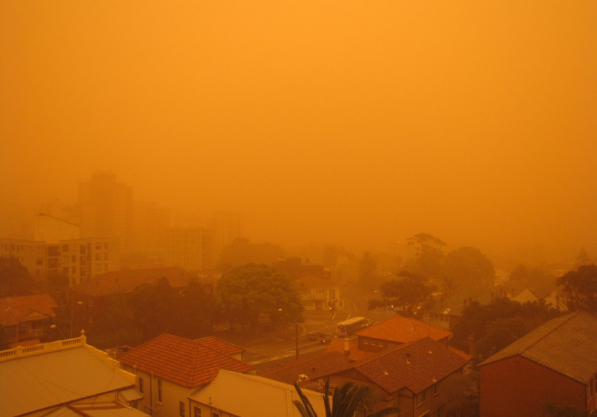
A dust storm whipped up in western New South Wales is due to arrive in Sydney today, bringing strong winds and a “dust haze”.
The storm progressed through Broken Hill and Griffith yesterday and should hit the Sydney metropolitan region around midday.
“Sydney is already looking a bit hazy … and we’re expecting the dust to thicken up over the next few hours,” Anita Pyne, a forecaster with the Bureau of Meteorology, told Broadsheet.
Never miss a Sydney moment. Make sure you're subscribed to our newsletter today.
SUBSCRIBE NOWDry soil conditions in the state’s drought-affected inland regions, combined with a cold front, have created prime conditions for a dust storm to blow across the state.
Light #dust already beginning to impact #Sydney #CentralCoast and #Illawarra. However the main band of thicker dust is still on the western slopes of the Great Dividing Range. We expect the dust to gradually thicken over Sydney in the next few hours. pic.twitter.com/3TvbekzzYg
— Bureau of Meteorology, New South Wales (@BOM_NSW) 21 November 2018
Pyne says residents may spot some red skies and haze, but says the storm is unlikely to be as severe as the 2009 dust storm that blanketed the city in an eerie, apocalyptic-looking red haze.
She says the cold front is a “huge long thing” that runs from the Victorian-New South Wales border, through Dubbo and Walgett, and up to the southern parts of Queensland.
Sydneysiders with respiratory conditions are advised to stay inside, though Pyne suggests most residents heed this advice. “It’s also going to be windy and gusty … it’s generally going to be unpleasant,” she says.
The dust storm is predicted to peak in the early afternoon, before it’s swept into the ocean in the evening.
The national forecaster has predicted Friday will be sunny and dust-free but with strong winds measuring up to 40 kilometres per hour.
The dust storm (red) that swept across NSW from west to east during the last 24 hours. pic.twitter.com/05KX89u3pC
— Weatherzone (@weatherzone) 21 November 2018
