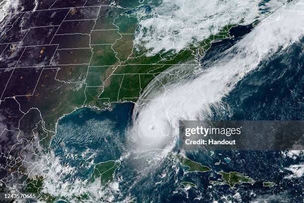
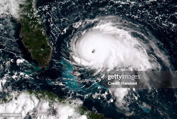
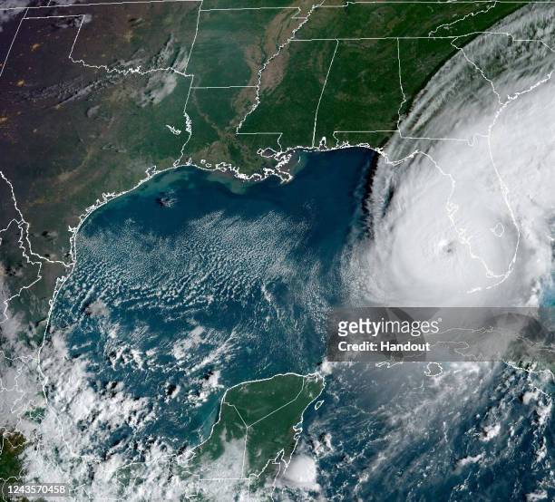
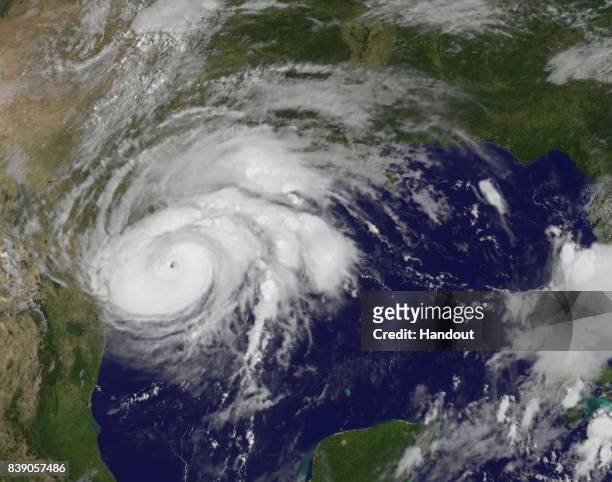
In this NOAA handout image taken by the GOES satellite at 13:26 UTC, Hurricane Ian moves toward Florida on September 28, 2022 in the Gulf of Mexico....
asia , day and night, satellite image of the earth - satellite image noaa stock pictures, royalty-free photos & images
In this NASA handout image taken from the International Space Station, Hurricane Ian moves through the Caribbean Sea on September 26, 2022 just south...
australia, day and night, satellite image of the earth - satellite image noaa stock pictures, royalty-free photos & images
In this NOAA handout image taken by the GOES satellite at 17:30 UTC shows Hurricane Ian as it moves toward western Cuba on September 26, 2022 in the...
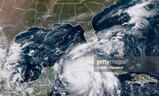
In this NOAA handout image taken by the GOES satellite at 13:10 UTC, Hurricane Ian approaches Florida on September 28, 2022 in the Gulf of Mexico....
In this NOAA handout image taken by the GOES satellite at 16:56 UTC: shows Hurricane Ian as it moves toward western Cuba on September 26, 2022 in the...
In this NASA handout image taken by Moderate Resolution Imaging Spectroradiometer on NASA’s Terra satellite, Hurricane Ian enters the Gulf of Mexico...
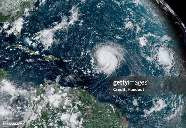
In this NOAA image taken by the GOES satellite, Hurricane Lee crosses the Atlantic Ocean as it moves west on September 8, 2023. Lee reached Category...
In this NOAA GOES-East satellite handout image, Hurricane Dorian, now a Cat. 5 storm, tracks towards the Florida coast taken at 13:20Z September 1,...
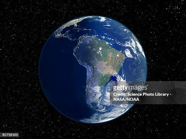
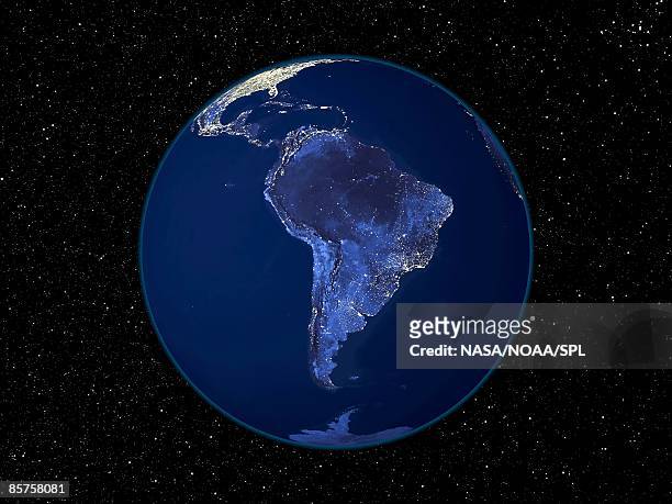
south america, day and night, satellite image of the earth - satellite image noaa stock pictures, royalty-free photos & images
africa at night, satellite image of earth at night - satellite image noaa stock pictures, royalty-free photos & images
asia at night, satellite image of the earth at night - satellite image noaa stock pictures, royalty-free photos & images
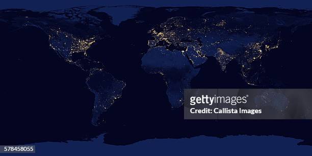
image of earth at night. composite assembled from data acquired by suomi national polar-orbiting partnership (suomi npp) satellite over nine days in april 2012 and thirteen days in october 2012 - satellite image noaa stock pictures, royalty-free photos & images
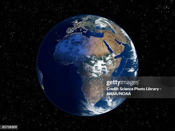
africa, day and night, satellite image of the earth - satellite image noaa stock pictures, royalty-free photos & images
In this satellite image provided by NOAA, Hurricane Florence churns through the Atlantic Ocean toward the U.S. East Coast, followed to the east first...
In this NOAA handout image taken by the GOES satellite at 13:26 UTC, Hurricane Ian moves toward Florida on September 28, 2022 in the Gulf of Mexico....
In this NOAA GOES-East satellite handout image, Hurricane Dorian, now a Cat. 4 storm, moves slowly past Grand Bahama Island on September 2, 2019 in...
In this NOAA handout image, the NOAA/NASA Suomi NPP satellite captures this infrared image of Hurricane Harvey just prior to making landfall at 18:55...
In this NOAA GOES-East satellite handout image, Hurricane Dorian, now a Cat. 1 storm, makes landfall on North Carolina’s Outer Banks at 16:36Z...
In this satellite image handout from National Oceanic and Atmospheric Administration , Hurricane Jimena is seen September 1, 2009 over the Baja...
north america at night, satellite image of the earth at night - satellite image noaa stock pictures, royalty-free photos & images
In this NOAA GOES-East satellite image, Hurricane Dorian, now a Cat. 2 storm with maximum sustained winds of 110 mph, gains strength as it tracks...
In this NOAA satellite handout image , shows Hurricane Florence as it made landfall near Wrightsville Beach, North Carolina on September 14, 2018....
In this NOAA satellite handout image, shows Hurricane Florence as it travels west and gains strength in the Atlantic Ocean southeast of Bermuda on...
north pole at night, satellite image of the earth at night - satellite image noaa stock pictures, royalty-free photos & images
arctic, day and night, satellite image of the earth - satellite image noaa stock pictures, royalty-free photos & images
In this NOAA GOES-East satellite handout image, Hurricane Dorian, now a Cat. 2 storm, inches northwest away from the Bahamas on September 3, 2019 in...
In this NOAA satellite handout image captured at 7:45 a.m. ET, shows Hurricane Florence as it made landfall near Wrightsville Beach, North Carolina...
In this NOAA handout image, NOAA's GOES satellite shows Hurricane Irma as it moves towards the Florida Coast in the Caribbean Sea taken at 16:15 UTC...
In this NOAA handout image, taken by the GOES satellite at UTC: 1650Z shows the tropical storm organizing in the Gulf of Mexico just west of Florida...
In this satellite image from NOAA, Hurricane Katrina is seen in the Gulf of Mexico August 28, 2005. According to reports, the storm has sustianed...
In this handout provided by the National Oceanic and Atmospheric Administration from the GOES-East satellite, a major winter storm develops over the...
In this NOAA handout image taken by the GOES satellite, Tropical Storm Hilary approaches the California coast on August 20, 2023. Southern California...
In this satellite image provided by National Oceanic and Atmospheric Administration , Hurricane Florence churns through the Atlantic Ocean toward the...
In this NOAA handout image, NOAA's GOES satellite shows Hurricane Irma as it moves towards the Florida Coast as a category 4 storm in the Caribbean...
This satellite image made available by NOAA shows weather systems across North America on Dec. 23 at 10:56 a.m. EST. Tens of millions of Americans...
In this NOAA handout image, taken by the GOES East satellite at 1915 UTC, Hurricane Hermine approaches the Gulf Coast of Florida on September 1,...
In this satellite image from the National Oceanic and Atmospheric Administration Tropical Storm Epsilon is seen November 29, 2005. The day before the...
In this handout satellite image taken by the Japan Meteorological Agency's MTSAT-2 satellite and provided by the National Oceanic and Atmospheric...
antarctica at night, satellite image of the earth at night - satellite image noaa stock pictures, royalty-free photos & images
australia at night, satellite image of the earth at night - satellite image noaa stock pictures, royalty-free photos & images
In this satellite image from NOAA , Typhoon Longwang is shown southeast of Okinawa, Japan on September 30, 2005. Maximum sustained winds are at 120...
In this handout provided by the National Oceanic and Atmospheric Administration from the GOES-East satellite, four separate weather system Halong,...
In this NOAA GOES-East satellite handout image, Hurricane Dorian, now a Cat. 4 storm, tracks towards the Florida coast taken at 13:40Z August 31,...
In this NOAA GOES-East satellite image, Hurricane Dorian leaves the Caribbean Sea and tracks towards the Florida coast taken at 18:40Z August 29,...
In this NOAA GOES-East satellite image, Hurricane Dorian leaves the Caribbean Sea and tracks towards the Florida coast taken at 14:20 UTC August 29,...
National Weather service satellite image showing Hurricane Floyd moving west in the Atlantic Ocean northeast of the Lesser Antilles in the direction...
south america at night, satellite image of the earth at night - satellite image noaa stock pictures, royalty-free photos & images
In this satellite image provided by the National Oceanic and Atmospheric Administration , Hurricane Ike moves in to the Gulf of Mexico and continues...
In this satellite image provided by the National Oceanic and Atmospheric Administration, Hurricane John is shown at 10:15am EDT southwest of Mexico's...
In this handout provided by the National Oceanic and Atmospheric Administration from the GOES-East satellite, a weather system travels over the...
In this handout from the National Oceanic and Atmospheric Administration , Super Typhoon Haiyan moves towards the Philippines November 7, 2013 in the...
In this NOAA handout image taken by the GOES satellite at 19:01 UTC, Hurricane Ian makes landfall as a Category 1 storm with 85 m.p.h. Winds...
This image obtained 22 May 2002 from the National Oceanic and Atmospheric Administration shows an iceberg, designated D-17, that has broken off from...
In this NOAA satellite handout image captured at 15:02 UTC, shows Hurricane Florence as it travels west in the Atlantic Ocean off the coast of the...
In this NOAA-NASA GOES Project handout image, GOES satellite shows Hurricane Irma as it makes landfall on the Florida coast as a category 4 storm...
In this NOAA handout image, NOAA's GOES satellite shows Hurricane Irma as it moves towards the Florida Coast in the Caribbean Sea taken at 03:30 UTC...
In this NOAA handout image, NOAA's GOES East satellite capture of Hurricane Harvey shows the storm's eye as the storm nears landfall at 10:07 a.m....
In this satellite image provided by the National Oceanic and Atmospheric Administration , Hurricane Gustav strikes the U.S. Gulf Coast at 15:15 UTC...