Bald Rock Campground | Bald Rock National Park | Campground Review
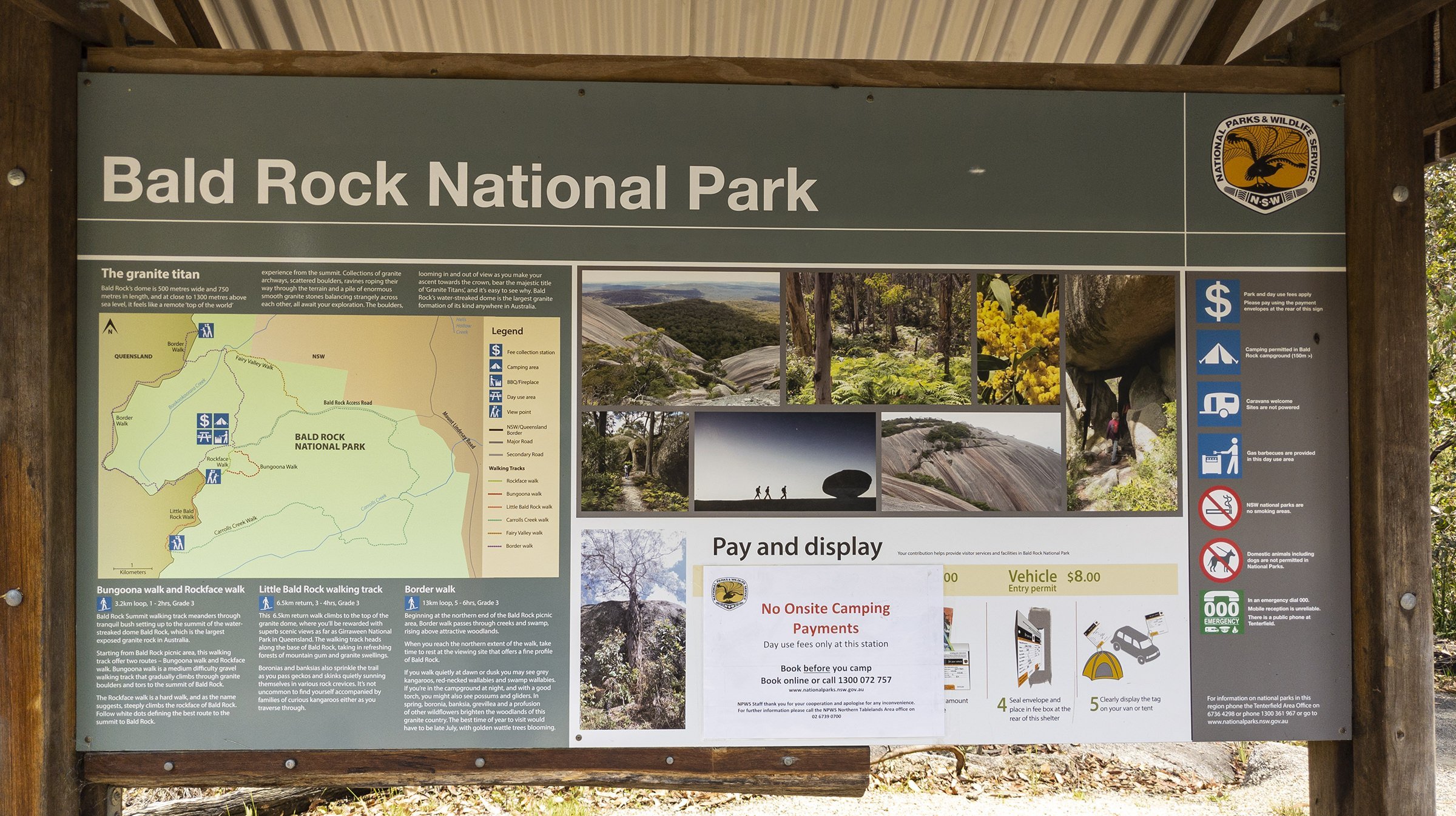
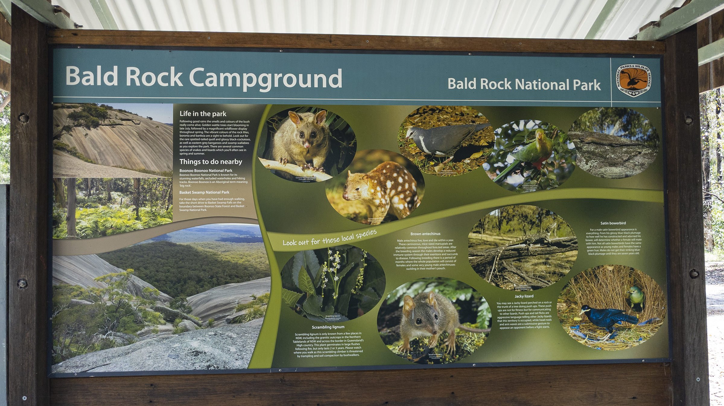
Located 30km north of Tenterfield on the Queensland border is the stunning Bald Rock National Park. The border passes over the rock on the Western side. On the other side of the border national park continues as the Girraween National Park. The park has granite gardens scattered across picturesque walks, leading to awe-inspiring lookouts over boundless countryside. The park is named after its most prominent feature, Bald Rock, which is a large granite outcrop rising about 200 metres above the surrounding landscape. Measuring about 750 metres long and 500 metres wide this is the largest granite monolith in Australia.
The two walking tracks are marked, a steep one up the exposed face, or an easier gradient through bushland around the back. The Bungoona Walking Track, built in 1980, goes more gently up the eastern side of Bald Rock and winds through forest. It passes through some granite boulder formations, including an arch, covered in mosses, ferns and orchids.

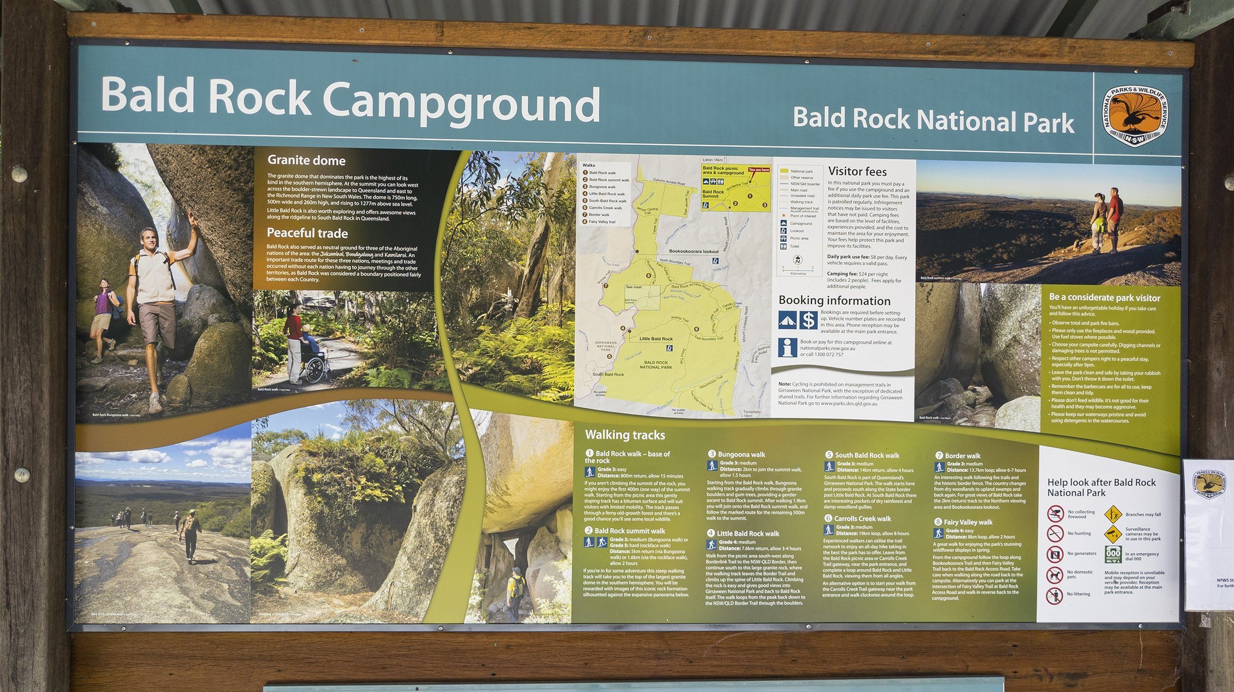
The summit offers panoramic views of the surrounding bushland, but vegetation on top prevents a full 360° view.

The views are so expansive, mountains as far north as the Queensland/New South Wales border can be seen, such as Mount Barney, Mount Lindesay and Flinders Peak, and as far south as Mount MacKenzie, south of Tenterfield.

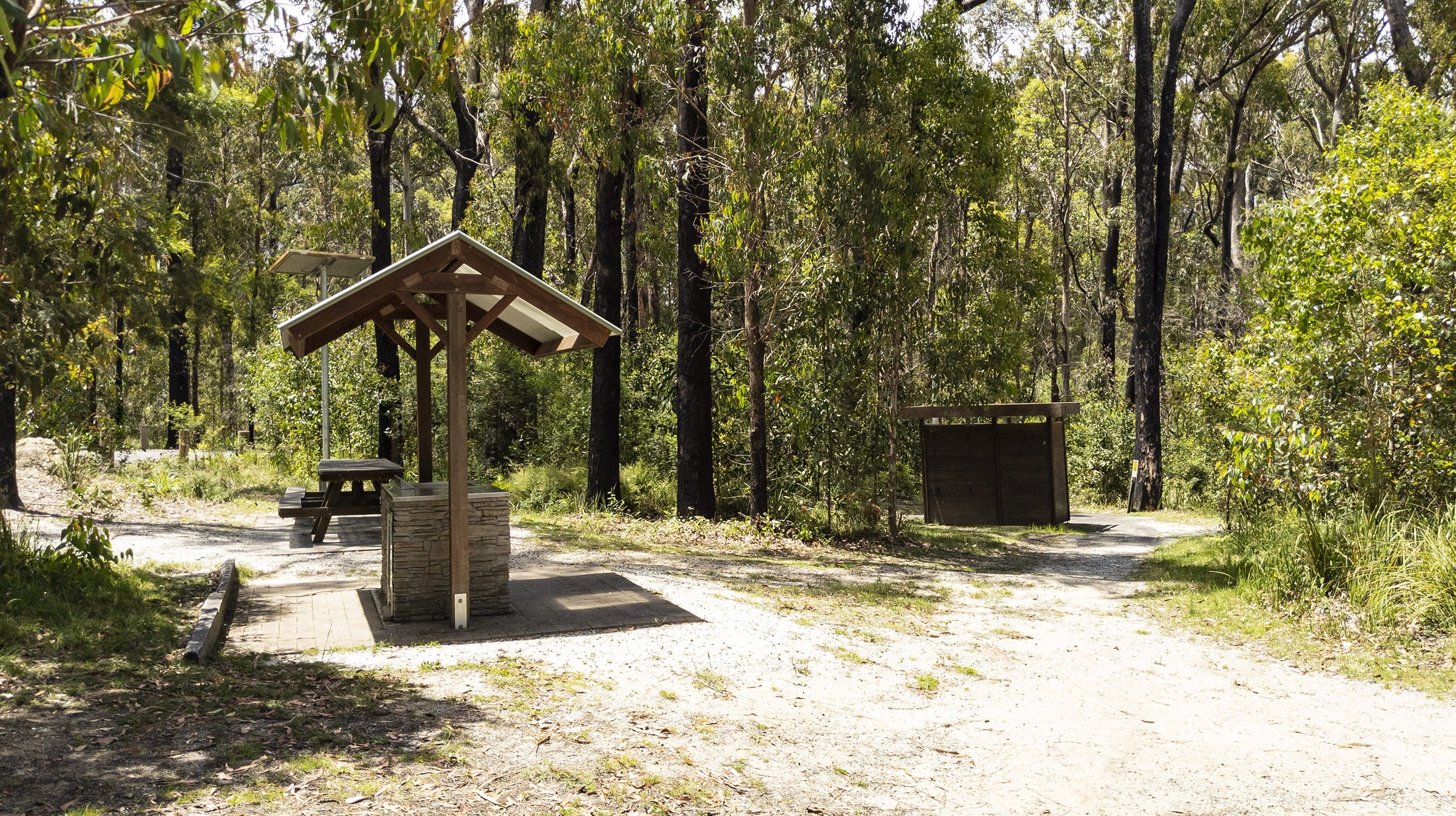
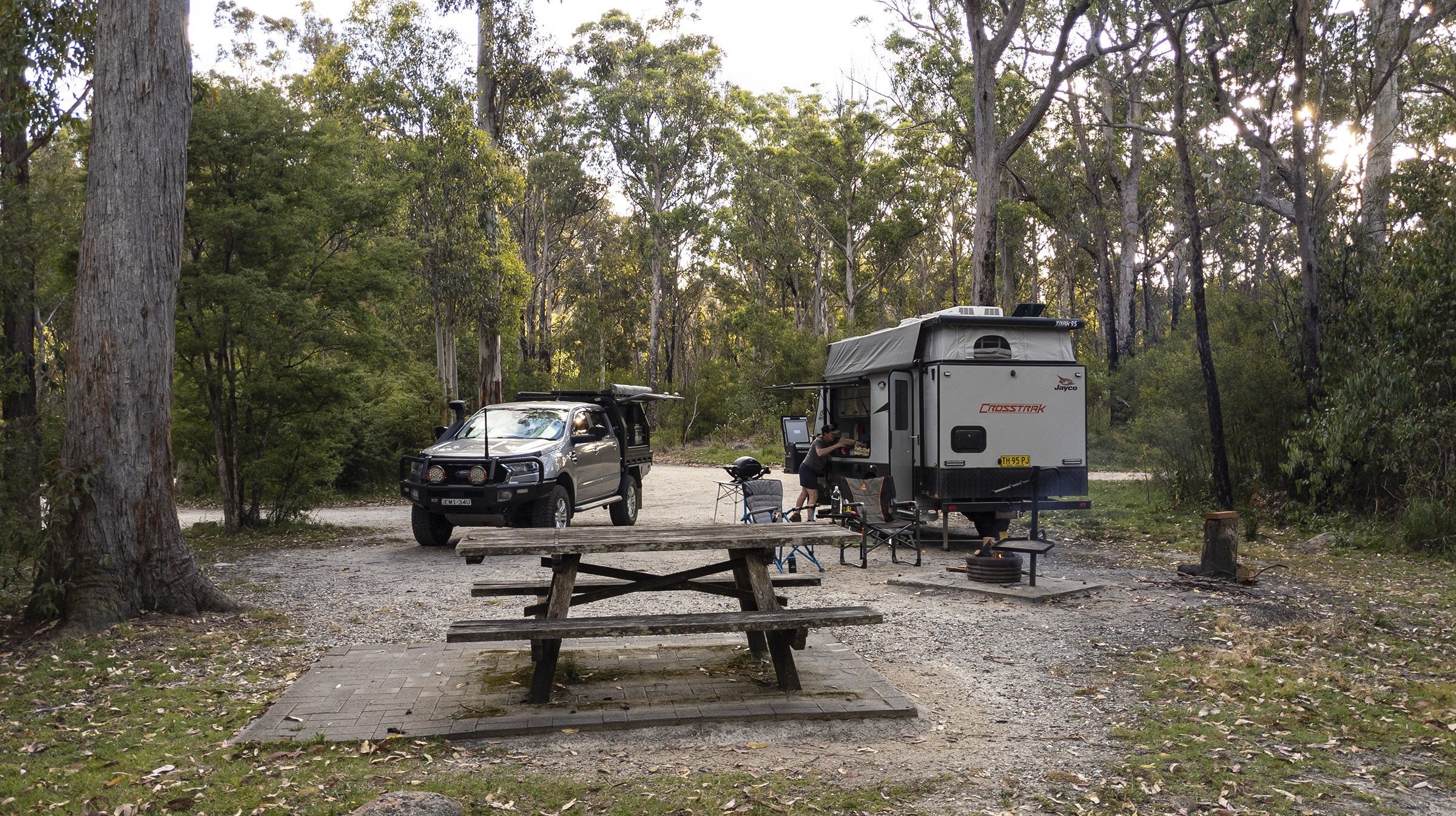
The campground has 13 sites. Each site has its own table and firepit. There are drop toilets available and a covered camp kitchen/BBQ area. The broader area day use area also has picnic tables, barbecue facilities, toilets and drinking water. As with most National Parks you can’t collect firewood within the boundary of the National Park, but there is a little stockpile that can be accessed.
You need to pre-book for this campground, and you book for a specified site, and bookings are done here - Bald Rock Campground
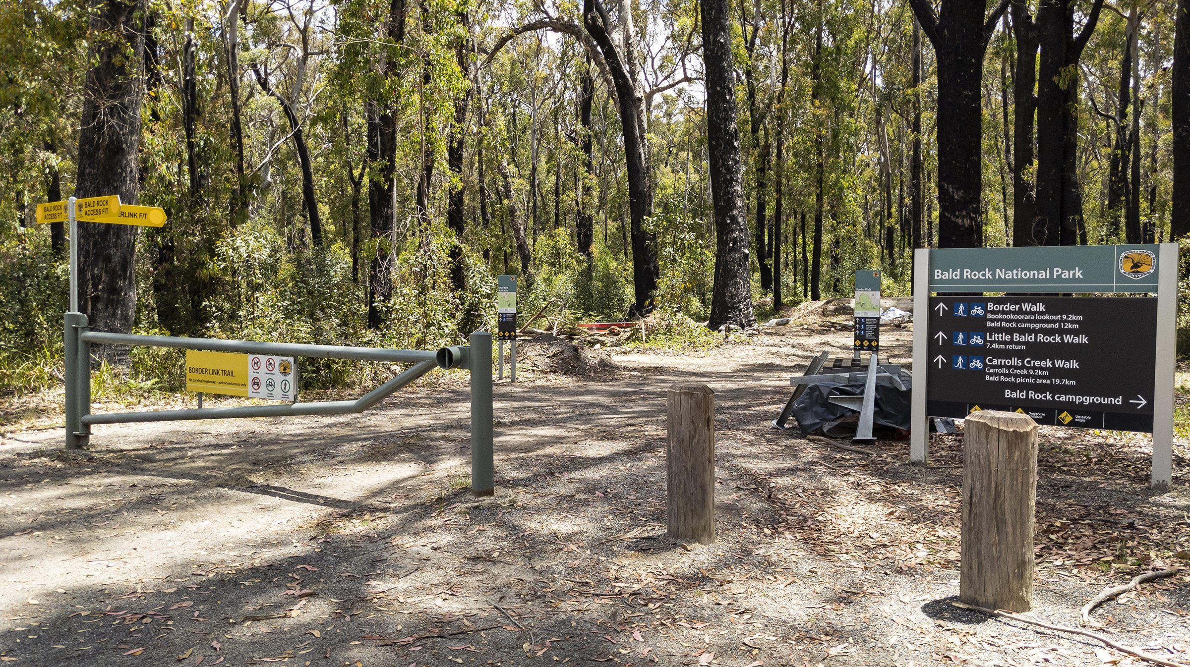
The campground has a loop road, and sites go from 1 to 13 from the left and back around to the start, and the entry to Site 12 can be seen to the right of the information board in the photo below. The information boards are the junction of the loop, with the covered camp kitchen/BBQ just on the left fork.

Entry / Exit junction

Covered BBQ area
Site 1
National Parks list this as a 9 x 12m site

The road goes up a little hill from site 1.

Site 2
National Parks list this as a 6 x 18m site.

Site 3
National Parks lists this as a 7 x 18m site ** please note may not always come with wildlife included !

Site 4
National Parks lists this as a 6 x 21m site

Site 5
National Parks lists this as a 7 x11m site.
The top toilet is located opposite site 5.

Site 6
We unfortunatelt didnt get a photo here, as it was occupied when we went for a wander, but it is pretty similar to site 7.
National Parks lists this as a 9 x13m site.
Site 7
National Parks lists this site as a 15 x 6m site. There is a side road to the left that Site 7 sits on. Going right takes you around the loop and there is a reasonable gap before you get to site 8 and site 9.

Site 8
National Parks lists this as a 12 x 16m site. There is a connector road between site and site 10, which you see on the left side of this photo, looking back to the main loop main.

Site 9
National Parks lists this as a 6 x 9m site

Site 10
National Parks lists this as a 4 x 18m site

Site 11
National Parks lists this as a 5 x 12m site

The lower toilet is situated at the entry/exit junction at site 12.

Site 12
National Parks lists this as a 11 x9m site

Site 13
National Parks lists this as a 13 x 15m site

General Day use / Picnic Area
Toilets, BBQ, picnic tables, walking trails.