
Morning glory cloud crosses Gulf of Carpentaria
Satellites captured a large morning glory cloud rolling across the Gulf of Carpentaria on Wednesday morning.
The morning glory cloud refers to a long solitary roll cloud, or sequence of roll clouds, which periodically appear over far northern Qld and the Gulf of Carpentaria.
The morning glory is famous in the Burketown region and a big attraction for glider pilots from all over the world, who come to ride the updrafts at the leading edge of the massive cloud.
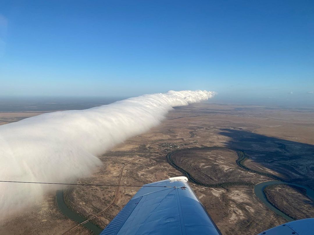
Image: A top-down view of a morning glory cloud near Burketown in October 2020. Source: @weatherbywill / Instagram
The morning glory cloud usually develops when:
- Opposing onshore winds converge over Cape Yorke Peninsula at night, causing air to rise.
- This air then descends at night.
- If a low-level temperature inversion is in place over the Gulf of Carpentaria, this descending air can trigger an atmospheric gravity wave that travels towards the west over the Gulf of Carpentaria.
- One or more roll clouds can form at the crests of these atmospheric gravity waves, because cooler air causes condensation near the wave crest, while sinking air behind each roll cloud causes clear air.
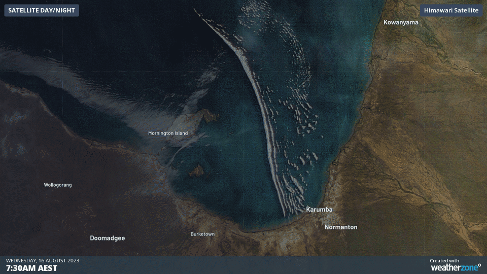
The satellite images below show the morning glory cloud on Wednesday morning. By sunrise the cloud had already moved west of Karumba and by 10am AEST it was positioned just north of Burketown.
Video: Morning glory cloud over the Gulf of Carpentaria on Wednesday, August 16, 2023.
This morning’s edition of the morning glory cloud was close to 300 km long.