
Tropical Low develops over the Gulf of Carpentaria
The first tropical low of the season for the Gulf of Carpentaria region has developed and is expected to move eastwards across the Gulf and intensify over the coming days.
The system is currently categorised as a tropical low pressure system and is located south of Groote Eylandt in the western Gulf of Carpentaria. The system is moving at a pace of 7km/h in a southeasterly direction towards Gulf Country in northwest Queensland.
This system is expected to continue moving in an east-southeasterly direction, potentially intensifying to a category 1 tropical cyclone overnight Sunday 3rd into Monday 4th. If this system reaches category 1 it will be named Imogen and be the first named system of the season in Australian waters. This system is currently expected to reach and cross the Gulf Coast on Monday, bringing gale force winds, abnormally high tides, large waves and heavy rainfall to coastal communities and areas over the southeastern parts of the Gulf.
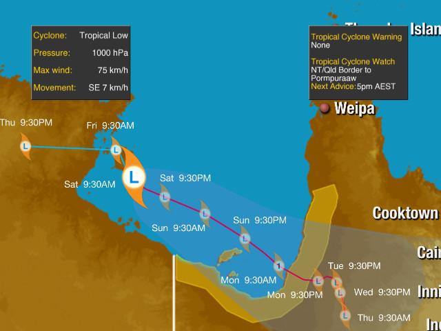
Tropical Cyclone Track map showing the current position of the tropical low over the western Gulf of Carpentaria, and its east-southeasterly movement into the southeastern portion of the Gulf, potentially briefly reaching Category 1 Tropical Cyclone strength on Sunday night/Monday morning, and crossing the coast on Monday.
Widespread flooding rainfall as this low pressure system makes landfall and loses intensity over land could amount to over 100-200mm of rain by the end of Tuesday next week over broad swaths of the Gulf Country region. Uncertainties on the track and intensity of these systems is usually quite elevated, but with a number of models predicting that this system will follow a general east-southeasterly track across the Gulf, the main question will fall upon the intensity of this system. Regardless of whether this system becomes the first Australian 2020-21 tropical cyclone or not, high winds, large waves and heavy rainfall should be expected over parts of the region in the coming days. To keep track of the latest tropical cyclone charts visit: https://www.weatherzone.com.au/charts/tropicalcyclone.jsp
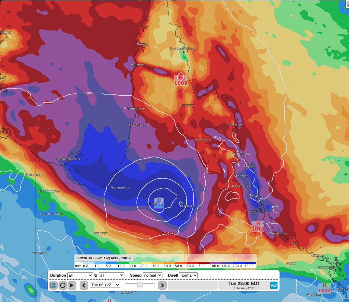
ECMWF modelled accumulated precipitation extending until 11pm AEDT on Tuesday showing large areas receiving over 200-300mm of rainfall.